Rest of the work week: A couple more unsettled days before late-July heat returns
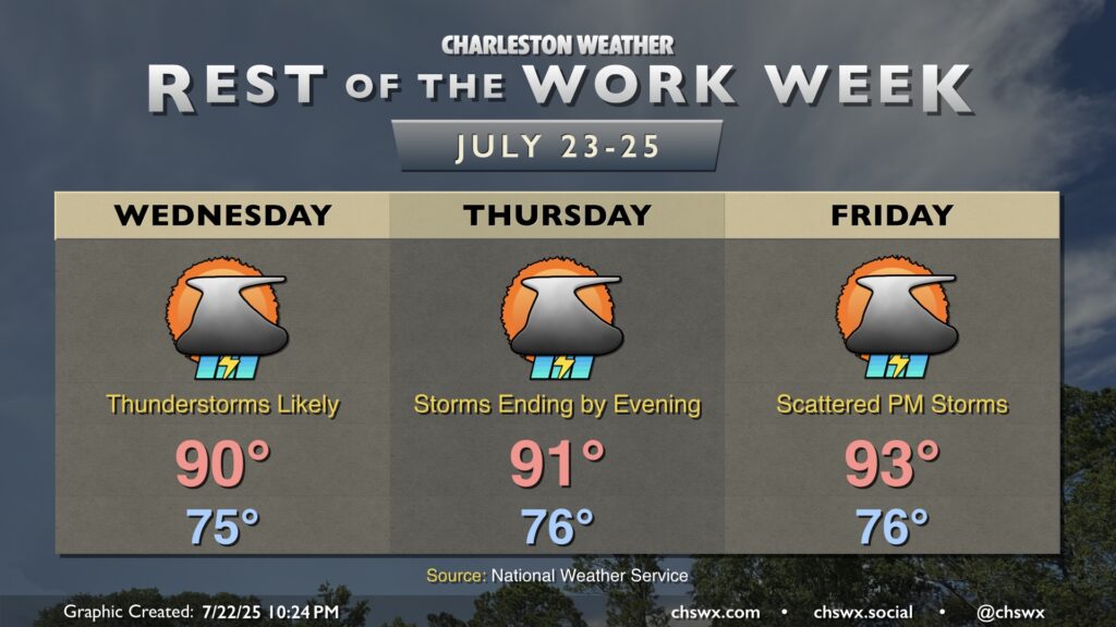
The stalled front that brought us some flooding rains and severe weather on Tuesday lingers over the next couple days before high pressure nudges in, sending rain chances down and temperatures up for Friday.
Showers and thunderstorms will once again be the main concern with plenty of moisture to wring out. A little less in the way of instability will temper both the severe weather and flash flood threat, but some spots will almost certainly see some heavy rain. Flood advisories will once again be possible, so be alert as you travel tomorrow. Showers and thunderstorms will hold temperatures down to around 90° in the afternoon, but it’ll still feel plenty humid.
The front will be breaking down as we get into Thursday, with high pressure and drier air starting to work in late. We’re still likely to see plenty of showers and thunderstorms during the day, but storm coverage should be diminishing by evening. Highs top out in the low 90s once again after another mild start in the mid-to-upper 70s.
The aforementioned high pressure builds in a bit more on Friday, putting a bit of a lid on the more widespread shower and thunderstorm coverage of the prior few days. Still, we’ll be dodging some scattered storms in the afternoon and evening hours. Temperatures will turn a bit warmer, with highs in the low to mid-90s expected. The warming trend continues into the weekend, with heat indices potentially approaching advisory criteria once again.