Rest of the work week: Heat continues, but with showers and storms for relief, too
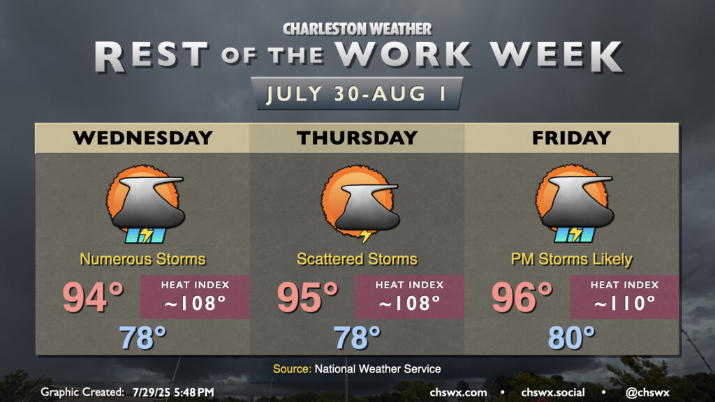
Our late-July heat wave continues for the rest of the work week, but thankfully with some afternoon and evening thunderstorms to help take the edge off a bit.
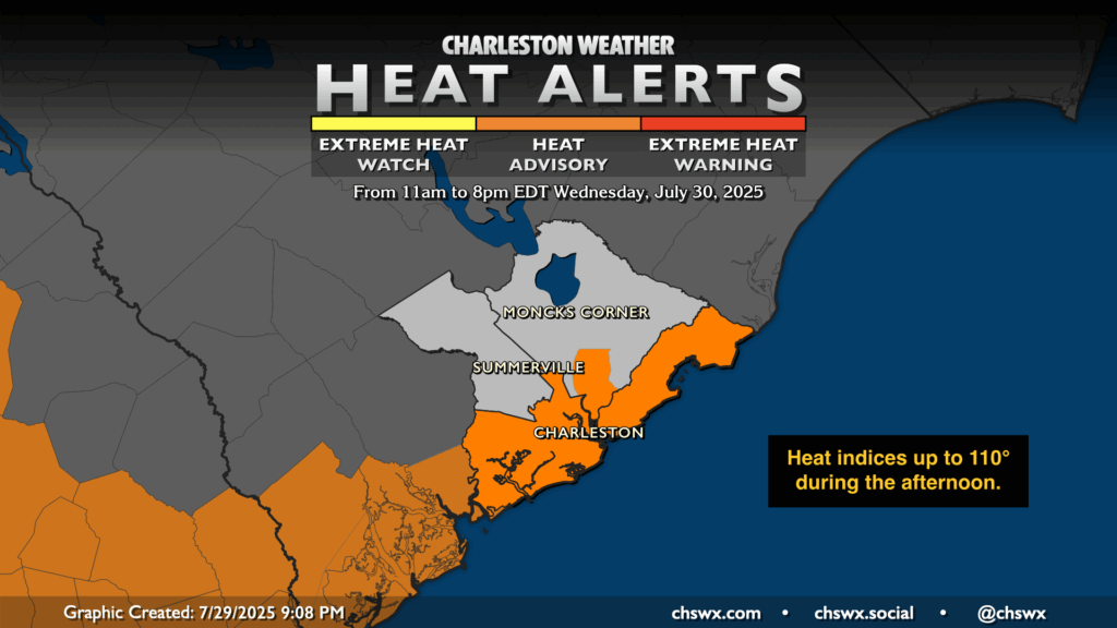
Another Heat Advisory will be in effect Wednesday for Charleston County as well as tidal Berkeley County (think Hanahan down to Daniel Island). It’s here where heat indices will rise into the 108-110° range, which is Heat Advisory criteria. Elsewhere in Berkeley and Dorchester counties, heat indices should fall just short of criteria, but they’ll still be quite elevated in the 105-107° range. Once again, it’ll be a steamy start to the day, with lows in the upper 70s to low 80s near the coast, and concerns around the ongoing, cumulative effect of heat stress will continue.
Showers and thunderstorms should initiate along and ahead of the seabreeze by early afternoon. Once again, they’ll be slow movers, and may dump quite a bit of rain in a short period of time in a few locations. The South Carolina DNR location at Fort Johnson reported 1.25” of rain in 25 minutes with one of Tuesday afternoon’s thunderstorms! While we may not see an exact repeat, the bountiful moisture in the atmosphere will certainly allow for such rainfall. Without any shear, though, storms will pop and eventually collapse. A stray strong storm can never be ruled out, but widespread severe weather is not expected.
Shower and storm coverage should decrease a little on Thursday, but we’ll still see a scattering of storms in the afternoon as temperatures once again head into the mid-90s with heat indices approaching 108°. Then, a front will approach from the north on Friday. This will help drive temperatures a little higher, with highs in the mid-to-upper 90s yielding heat indices around 110° or so. Shower and thunderstorm chances will head up in the late afternoon into the evening hours, and will be with us for several days as the front sinks in and stalls out.
Follow my Charleston Weather updates on Mastodon, Bluesky, Instagram, Facebook, or directly in a feed reader. Do you like what you see here? Please consider supporting my independent, hype-averse weather journalism and become a supporter on Patreon for a broader look at all things #chswx!