Weekend forecast: Staying on the stormy side
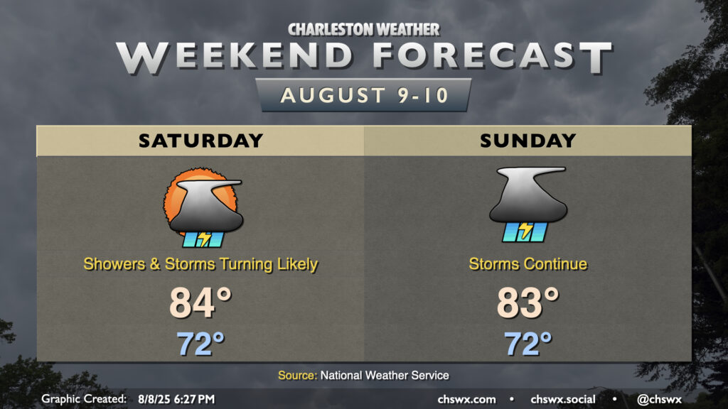
Cooler-than-normal temperatures continue this weekend, but the cost is continued rounds of showers and thunderstorms as moisture overruns a stationary front to the south and a trough of low pressure develops aloft.
Saturday should see some peeks of sun, but showers and thunderstorms will be possible for much of the day, turning more likely in the afternoon and evening as the seabreeze develops and moves slowly inland. It’ll be another cooler-than-normal day, with lows in the low 70s warming to the mid-80s (at best) in the afternoon as we dodge showers and storms. It shouldn’t rain all day at any one location, but when it does rain, it could be heavy at times. The best rain chances will be found along and east of 17-A, closest to the strongest moisture convergence.
Sunday looks similar to, if not even slightly more unsettled, than Saturday. Once again, temperatures start in the low 70s and warm to the low-to-mid-80s in the afternoon, with the best chance of reaching those temperatures happening further inland where rain chances will be a little lower, but far from non-zero. Once again, periods of heavy rain will be possible, especially as we get closer to the coast.
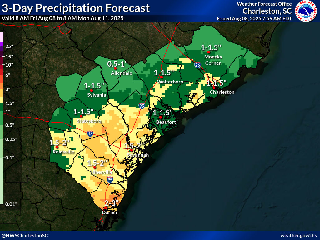
Overall, the NWS forecast for this weekend’s rainfall is for 1-1.5″ of rain across much of the metro area, with upwards of 2-3″ possible in some spots. This isn’t ideal for outdoor activities, but we will continue to chip away at the overall rainfall deficit (though drought conditions are not an issue in the Lowcountry).
Stay dry out there!
Follow my Charleston Weather updates on Mastodon, Bluesky, Instagram, Facebook, or directly in a feed reader. Do you like what you see here? Please consider supporting my independent, hype-averse weather journalism and become a supporter on Patreon for a broader look at all things #chswx!