The week ahead: Drier, then cooler
The main weather story this week will be much more pleasant than last week’s: cooler, drier air working into the area will bring along a decent early-fall preview to close out August, though a few storms will be possible heading into late week.
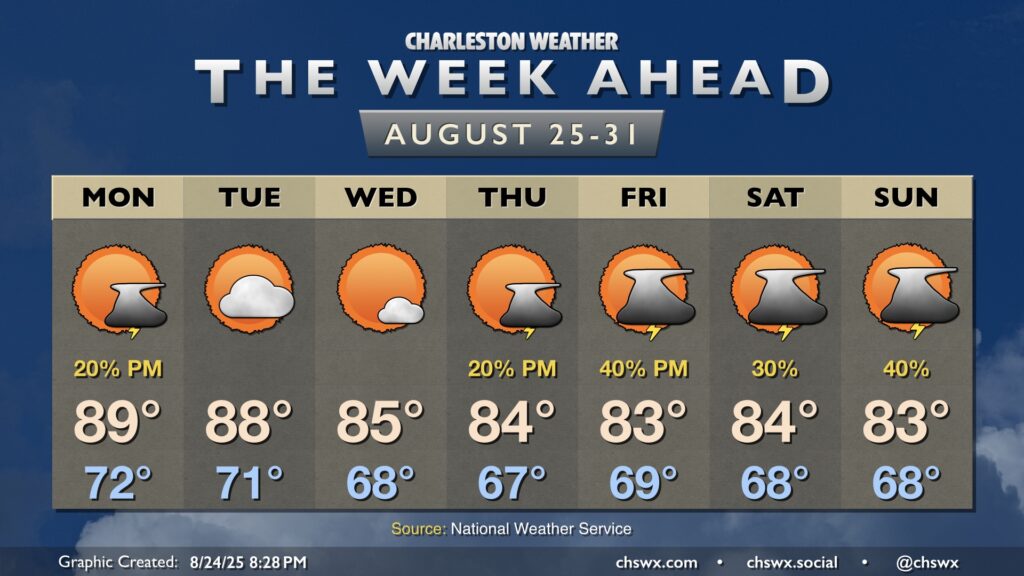
The week gets off to a warm start, though, as a secondary front approaches from the northwest. There’s a lot of sinking air aloft that will help keep the lid on most shower and thunderstorm activity, but a stray storm or two can’t be totally ruled out in the afternoon as the front approaches. Lows on Monday run in the low 70s, warming to near 90° in the afternoon.
The front clears the area Tuesday, ushering in a first round of drier and slightly cooler air. Dewpoints fall to the mid-60s during the day, and highs in the upper 80s won’t feel so bad as a result. Expect mostly sunny skies for the balance of the day, with clouds increasing late as a second front approaches.
This front will usher in another shot of cooler and drier air, which will send temperatures well below normal for the rest of the week. Wednesday starts in the upper 60s, warming to the mid-80s in the afternoon under partly cloudy to mostly sunny skies. It should be a really nice day as dewpoints fall into the low 60s.
Forecasted high temperatures generally remain in the low to mid-80s for the rest of the week as high pressure ridges southwestward from the northeast. The main question will be how far southward the driest air can punch in. Models generally depict a disturbance that will traverse the area late week into the weekend that will bring shower and thunderstorm chances back into the weather picture, though a repeat of this past weekend is not expected, thankfully. We’ll keep an eye on it!