Rest of the work week: A beautiful Wednesday before shower and storm chances re-enter the picture
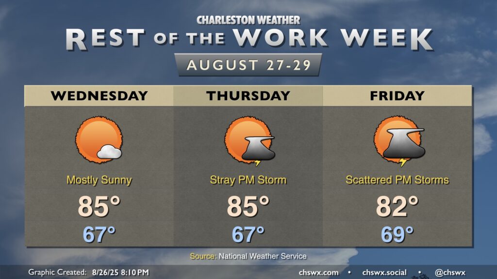
Cooler and drier air will continue to push into the area overnight into Wednesday, yielding a well-deserved beautiful day across the Lowcountry with comfortable warmth and few clouds. We start the day in the mid-to-upper 60s, warming to the mid-80s in the afternoon. Dewpoints mixing down to the low 60s — and perhaps as low as the upper 50s — will feel quite good!
Unfortunately, dewpoints begin to head back up starting Thursday as low pressure organizes over the Gulf. Thursday will still be a fairly nice day, but a stray shower or storm will be possible in the afternoon as the seabreeze moves ashore. The better rain chances start to kick up heading into Friday and, unfortunately, Labor Day weekend, as waves of low pressure develop along a stalled front to our south, spiking our rain chances at times. Rain could be heavy at times as we head into the weekend, but there’s still quite a bit of divergence in the model solutions this far out so it’s tough to tell just how much rain will fall. What we won’t see, though, is a repeat of last weekend — and hopefully we won’t do that again for a long while.