Friday & the weekend: Pleasantly warm; midday coastal flood issues
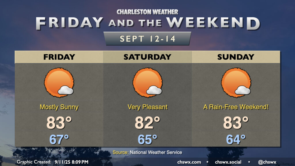
More sunshine will show itself starting Friday and lasting into the weekend courtesy of continued high pressure and northeasterly winds keeping a feed of cooler and drier air coming in. All in all, we can expect lows in the mid-60s each morning, with highs peaking in the low to mid-80s in the afternoon. Fun fact: This looks like the first weekend since July 26-27 without at least a trace of rain at either of the climate sites, so suffice it to say, we are very, very due for a quiet weekend of weather.
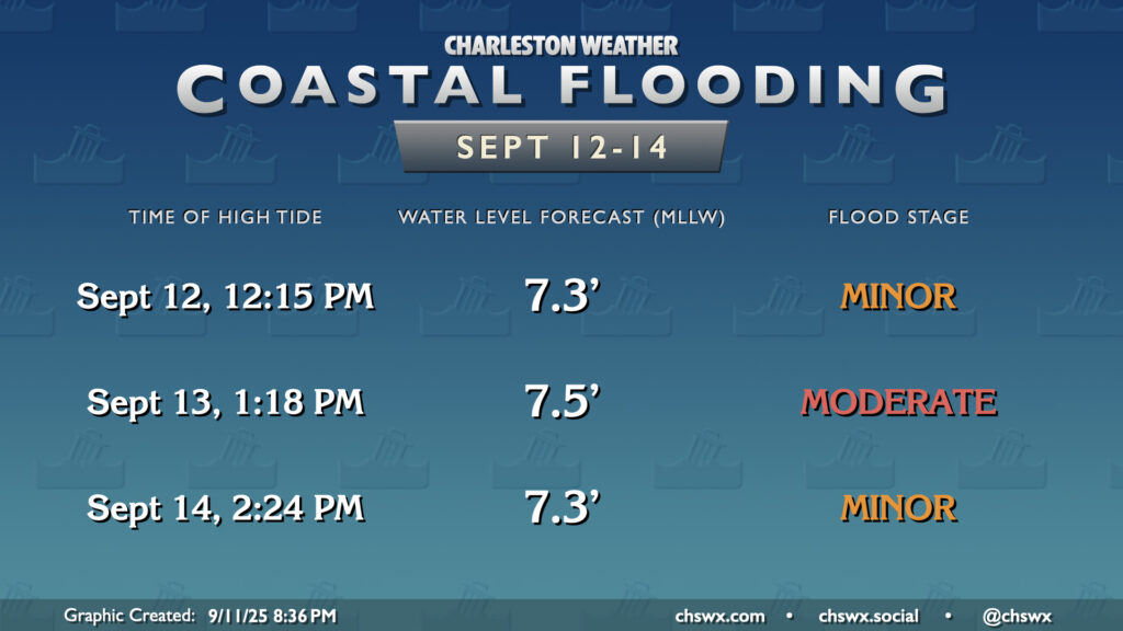
The only issue will come in the form of tidal flooding during the midday high tides through the weekend (and perhaps beyond). This is due to the continued northeasterly fetch and lingering high water levels from the past few days. Minor flooding is expected with the noon high tide on Friday, while moderate flooding is possible around the 1:18 PM high tide on Saturday. Water levels start to back off a bit more on Sunday, but minor flooding is once again expected around the 2:24 PM high tide. Road closures are a decent bet, especially on Saturday, so keep an ear out for Coastal Flood Advisories from the National Weather Service and be ready to reroute if downtown is in your plans.
Follow my Charleston Weather updates on Mastodon, Bluesky, Instagram, Facebook, or directly in a feed reader. Do you like what you see here? Please consider supporting my independent, hype-averse weather journalism and become a supporter on Patreon for a broader look at all things #chswx!