Weekend forecast: Spring-like warmth before a wintry chill
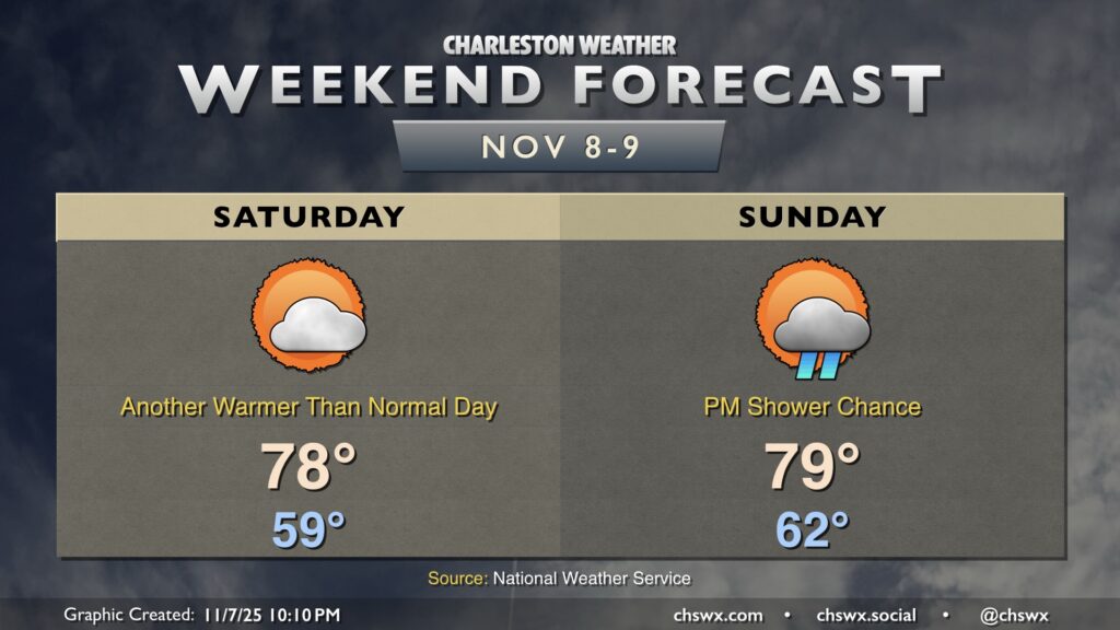
A couple more warm days lie ahead before the coldest airmass of the season crashes into the area next week. Saturday will generally feature temperatures in the upper 70s after starting the day near 60°. We’ll keep a few clouds around, but the risk for any rainfall should be very low.
A strong front approaches the area Sunday, and there’s a chance that some showers and maybe a thunderstorm could move through in advance, but the risk will be diminishing as the front pushes eastward as moisture doesn’t look to be in abundance. Temperatures Sunday peak near 80° after starting in the low 60s.
Looking ahead: First freeze likely Monday night
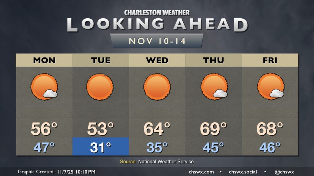
Big changes are in store starting Monday in the wake of the aforementioned cold front. Temperatures will fall well below normal for January, much less November, as chilly high pressure builds in. Lows on Monday bottom out in the mid-40s, but highs will struggle into the mid-50s as cold air blows in. We’re likely to see the first freeze of the season Monday night into Tuesday morning as lows fall into the upper 20s inland to low 30s in the metro area, with winds making it feel even colder. Temperatures will only peak in the low to mid-50s once again despite full sunshine.
After another chilly start on Wednesday, temperatures will start a warming trend back toward where we should be for the middle of November. Temperatures Thursday and Friday recover into the upper 60s each afternoon with lows in the mid-40s. No rain is expected at all during the week — not terribly out of bounds, climatologically speaking, for November, which tends to be the driest month of the year.