Rest of the work week: Warming trend commences after record lows Tuesday
Record lows were tied both at North Charleston as well as Downtown Charleston Tuesday morning as a potent shot of Arctic air swung through the area. The low at the airport fell to 29°, tying the record first set in 1943, while Downtown fell to 32°, tying the record low first set in 1913. A record cold high temperature appears to have been set as well at the airport, with the high only reaching 49° for the day, breaking the record of 54° set in 1968. Downtown also only peaked at 49°, but the record cold high temperature of 46°, set in 1913, remains safe. The freezing temperatures put an end to the growing season, which means that there will be no more Frost and Freeze products from the National Weather Service until the season resumes in March.
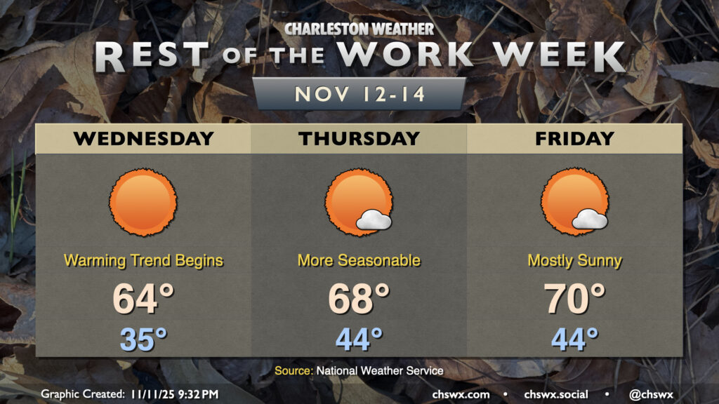
The good news is that a warming trend begins Wednesday. Temperatures will bottom out around or below freezing further inland, but should only drop to about the mid-30s closer to the coast and in the metro area. Temperatures will rebound quite nicely under full sunshine, with highs peaking in the mid-60s in the afternoon. This is still a little off the normal high for this point in November, but only by about 5-6° as opposed to 22°! The warming trend continues Thursday into Friday as the airmass continues to moderate under high pressure, with just a few clouds from time to time. Overall, there continues to be no major weather concern this week now that we have last night’s freeze behind us.