Rest of the work week: Temperatures head well above normal
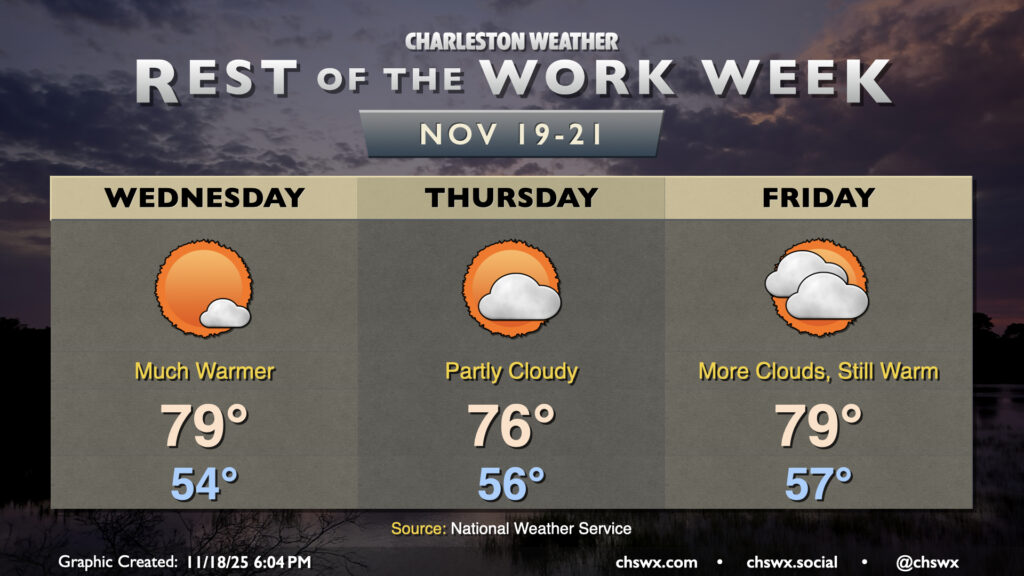
The main weather story for the rest of the work week will be unseasonable warmth courtesy of a ridge building in aloft. Temperatures will run well above normal, with highs approaching 80° particularly Wednesday and Friday (and maybe Thursday, depending on the position of a cold front to the north).
We may dodge a little fog Wednesday morning, but otherwise, expect the day to start on the mild side — generally mid-50s — before warming to near 80° in the afternoon under mostly sunny skies. Thursday could feature a little more in the way of clouds and perhaps a slight cooldown as a front approaches from the north and stalls out nearby. North of the front, temperatures should peak in the mid-70s, while south of it, temperatures could peak in the upper 70s to low 80s. Whatever cooldown takes place, if any, will be short-lived as the front buckles back northward on Friday, allowing temperatures to once again soar into the upper 70s to low 80s.
We’ll have one more warm day on Saturday before a front comes through and knocks temperatures down a little bit for Sunday, though we can expect above-normal temperatures to continue well into next week. Looking for rain? Well, rain chances for Saturday appear slim with the bulk of the energy remaining to the north, and any rain that falls should generally be light. Model guidance suggests there may be another risk for rain around Thanksgiving, but we’ll see how that ultimately pans out. Stay tuned.
Follow my Charleston Weather updates on Mastodon, Bluesky, Instagram, Facebook, or directly in a feed reader. Do you like what you see here? Please consider supporting my independent, hype-averse weather journalism and become a supporter on Patreon for a broader look at all things #chswx!