Rest of the work week: Turning warmer, but still cooler than normal
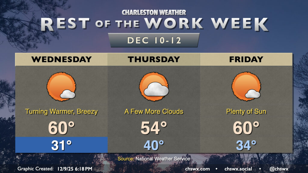
After another cold start on Wednesday, we’ll see temperatures climb a bit, though it’ll still be on the chilly side of normal, especially Thursday as a reinforcing front kicks up the cloud cover a bit.
The bar for “warmer days” is quite low these days. The high of 43° at the airport on Tuesday, set around 12:30am, is typically the normal low temperature for December 9 and is 21° below the normal high (which is typically 64° for this point in the year). So, while Wednesday will start below freezing, the sunnier sky and departing high pressure will allow the high to reach about 60° in the afternoon. It’ll be a bit breezy, with gusts 20-25 MPH expected in the afternoon, but it won’t be 43° and cloudy, either!
Cloud cover does return a bit for Thursday as a reinforcing front moves by. We shouldn’t get any rain out of it, but the uptick in cloud cover and reinforcing shot of cooler air will limit highs to the mid-50s after starting the day around 40°. More sunshine returns Friday as temperatures rebound to around 60° in the afternoon under plenty of sunshine.
Weekend outlook: Turning warmer
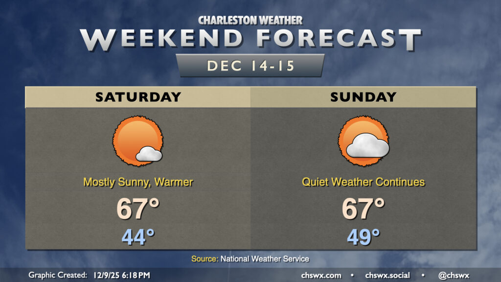
High pressure will once again slip more offshore over the weekend, and it looks like generally quiet weather with warmer-than-normal temperatures will feature prominently. Saturday will have a little more in the way of sunshine than Sunday, when the next front will be approaching. Right now, most models remain on the dry side with this frontal passage, though another shot of cool air will greet us on Monday.
Follow my Charleston Weather updates on Mastodon, Bluesky, Instagram, Facebook, or directly in a feed reader. Do you like what you see here? Please consider supporting my independent, hype-averse weather journalism and become a supporter on Patreon for a broader look at all things #chswx!