Rest of the work week: Clouds and rain return, but clear out ahead of a nice weekend
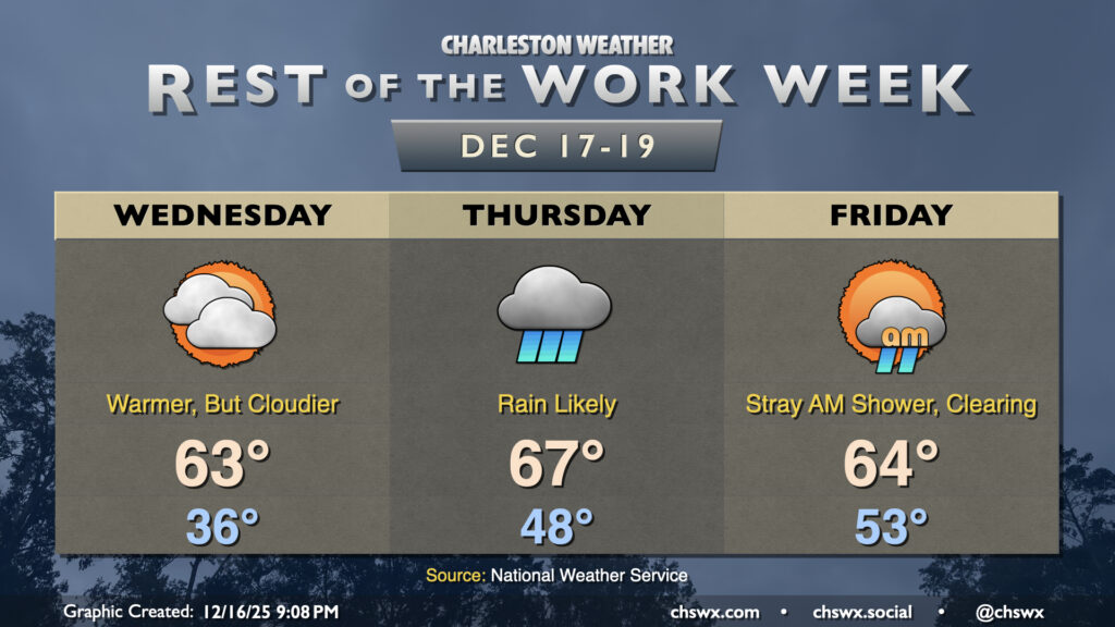
We’ll continue to put Monday’s cold snap in the rear view on Wednesday as temperatures continue to trend warmer with high pressure moving eastward. Temperatures will fall to the mid-30s overnight, but increasing cloud cover should keep a lid on further radiational cooling and keep us above freezing. From there, we’ll warm into the low-to-mid-60s as the cloud deck continues to thicken courtesy of a coastal trough taking shape offshore.
A wave of low pressure aloft will swing through Thursday, interacting with the inland-moving coastal trough and increasing moisture to bring us fairly solid rain chances, especially as we get into the afternoon. Warmer air will continue to move in, though, and we’ll start the day in the upper 40s to near 50° while warming to the mid-to-upper 60s in the afternoon despite the rain. A rumble of thunder isn’t out of the question, either, but nothing out of bounds is expected. Overall, most of us can expect a half-inch of rain or so, with locally higher (and, for that matter, lower) amounts depending on how things set up.
We may contend with a stray shower or two Friday morning, but the rain will be on the outs along with the cloud cover as the day goes on as a cold front clears the area. We’ll start in the low-to-mid-50s, warming to about the mid-60s in the afternoon as sunshine increases. The good news is that this isn’t a particularly strong front, so don’t expect a return of Monday’s cold snap!
Weekend outlook: Generally quiet and seasonable
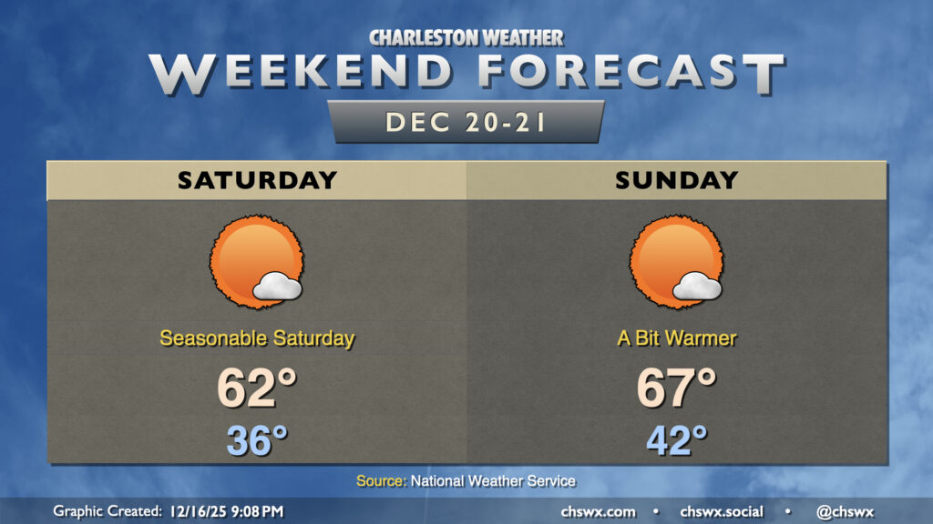
The last shopping weekend before Christmas is looking pretty good overall. Temperatures on Saturday start in the mid-30s (with maybe a few freezing readings well inland), but will warm to the low 60s under mostly sunny skies — generally right where we would expect to be on December 20, climatologically speaking. Winds go a little more westerly on Sunday, and we’ll have a seasonably warm day in store with lows in the low 40s warming to the mid-to-upper 60s with plenty of sunshine once again. Quiet weather looks to continue through at least Tuesday, but we’re still a bit far out to know how things are going to look around Christmas. Stay tuned.
Follow my Charleston Weather updates on Mastodon, Bluesky, Instagram, Facebook, or directly in a feed reader. Do you like what you see here? Please consider supporting my independent, hype-averse weather journalism and become a supporter on Patreon for a broader look at all things #chswx!