Friday & the weekend: Rain clears out ahead of a nice weekend
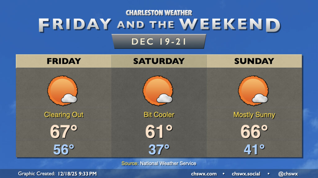
A front will sweep away the dreary and damp Thursday, yielding a much nicer Friday with much more sunshine. We’ll start the day in the mid-50s with some cloud cover still hanging around, but that should depart by midday. Temperatures will warm to the mid-to-upper 60s with breezy westerly winds, which will be gusty early in the day, peaking in the 20-25 MPH range. Winds will gradually slacken some as the day goes on, though.
Cooler air sets in for Saturday. We’ll wake up in the mid-to-upper 30s, with a northeasterly breeze sending wind chills down to around freezing. We’ll warm to the low 60s in the afternoon under mostly sunny skies. The airmass moderates for Sunday, and we start in the low 40s, warming to the mid-60s in the afternoon with plenty of sunshine once again.
We’ll keep the sunshine going well into next week and through Christmas. Monday will be a bit on the chilly side, but by the time we reach Christmas Eve, temperatures are back into the 60s and flirting with 70°.
Follow my Charleston Weather updates on Mastodon, Bluesky, Instagram, Facebook, or directly in a feed reader. Do you like what you see here? Please consider supporting my independent, hype-averse weather journalism and become a supporter on Patreon for a broader look at all things #chswx!