The week ahead: Warmer-than-normal Christmas this go-around
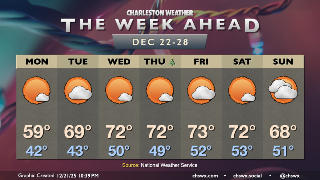
The main weather story for the week ahead — including Christmas Day — will be much warmer-than-normal temperatures as high pressure aloft will remain the dominant weather feature across a good bit of the continental US.
Monday will be the exception to the rule, though, as surface high pressure to the north keeps things on the cool side. We’ll see some gusty winds, too, with gusts 20-25 MPH possible through a good bit of the day before slackening later in the day. Lows on Monday start in the low 40s, with highs rising to around 60° in the afternoon under mostly sunny skies.
Temperatures start to really warm up starting Tuesday, when highs approach 70° after starting the low 40s once again. We’ll break into the low-to-mid-70s by Wednesday, and highs will generally stay there through Saturday and likely into Sunday depending on the behavior of an incoming front.
There’s no rain on the horizon this week, it looks like, so no concerns for sleigh aviators are expected at this point. We’ll keep an eye on fog potential, though.
Follow my Charleston Weather updates on Mastodon, Bluesky, Instagram, Facebook, or directly in a feed reader. Do you like what you see here? Please consider supporting my independent, hype-averse weather journalism and become a supporter on Patreon for a broader look at all things #chswx!