Friday & the weekend: On track for the first rain of 2026 on Saturday
I hope you and yours are having a nice and safe start to your 2026! We certainly have had a nice day of weather on Thursday to kick the new year off right, but the first storm system of the year won’t waste any time getting through the area on Saturday.
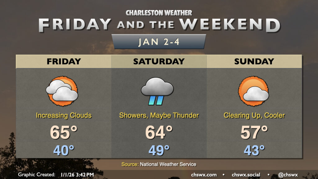
The first signs will arrive on Friday as cloud cover increases ahead of developing low pressure to the west, which will track across the Deep South during the day. We’ll get Friday in rain-free and on the warm side, with lows around 40° warming to the mid-60s in the afternoon as warm air pumped in via southwesterly winds overcome the increasingly cloudy skies.
Low pressure and its associated cold front affect the area on Saturday with shower chances pretty much all day, with the greatest risk for showers generally from the late morning to early evening hours. There is a chance we could see a thunderstorm or two as well. While there’s ample wind shear, instability will be rather limited in our neck of the woods, but a few strong gusts aren’t out of the question with any storms that can develop. The greater risk for any severe weather will be found to our west and southwest where there’s a better chance for more instability to develop. We’ll keep an eye on this to see if the risk spreads further into our area, but it’s nothing to really get overly concerned about at this point. Temperatures will peak in the mid-60s after starting near 50° in the morning, governed by the cloud cover and rainfall.
The rain won’t ruin the whole weekend, though, as the front moves through overnight Saturday. By Sunday morning, cloud cover will be on its way to dispersing as cooler and drier air moves in behind the front. Expect lows in the low-to-mid-40s to warm to just the upper 50s in the afternoon despite the increasing sunshine as the cooler air continues to blow in. From there, expect dry weather to continue and temperatures to warm well above normal especially heading into the second part of next week, with perhaps some 70s on the horizon.
Follow my Charleston Weather updates on Mastodon, Bluesky, Instagram, Facebook, or directly in a feed reader. Do you like what you see here? Please consider supporting my independent, hype-averse weather journalism and become a supporter on Patreon for a broader look at all things #chswx!