Rest of the work week: Another uptick in warmth
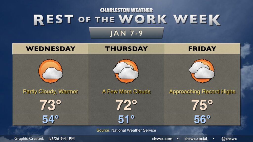
Warmer-than-normal temperatures will continue for the rest of the work week, with a stretch of 70° days expected beginning Wednesday. Lows Wednesday bottom out in the mid-50s — typical early January lows are closer to the upper 30s — while warming to the low-to-mid-70s under partly cloudy skies.
A few more clouds work their way in for Thursday and Friday as high pressure traverses to our north and a storm system to the west chucks some cirrus our way. We’ll cool down a touch for Thursday, but we will still remain well above normal as high pressure starts to ridge overhead. By Friday, surface high pressure is back offshore, and warmer air pumps right back in, sending temperatures to the mid and perhaps upper 70s, which may challenge record highs.
The next cold front approaches Saturday, which will be one more near-record-warm day before the front sends temperatures plunging below normal for Sunday into early next week.