Rest of the work week: A few showers possible Wednesday, then turning colder
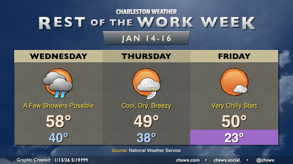
Another big cooldown is in store as we get beyond Hump Day and head into the second half of the work week. First, though, we’ll have a relatively seasonally-appropriate Wednesday, with highs topping out in the upper 50s to around 60° after a low around 40°. There will be a bit more in the way of cloud cover, with a chance for a few showers in the afternoon as low pressure moves northward out of the Bahamas, spreading a little moisture our way. Don’t expect much in the way of any meaningful rainfall, though, if you see any at all.
Changes begin to arrive Thursday as a series of cold fronts move through the area. Thursday starts in the upper 30s, warming only to the upper 40s to around 50° in the afternoon as breezy northwest winds with gusts pushing 20+ MPH pump in the cooler and drier airmass. This will increase fire danger across the area, so use extreme caution if you must burn anything (or just don’t burn at all). Cloud cover will gradually scour out throughout the day, and we should be down to just a few clouds around sunset. From there, winds calm down and the bottom falls out of the mercury as excellent radiational cooling conditions set up.
Expect Friday to start out very cold, with lows in the metro falling into the low 20s. Upper teens can’t be ruled out further inland and in sheltered rural areas. A light northerly breeze may be enough to knock wind chills down to around 20°, which will flirt with Cold Weather Advisory criteria. Suffice it to say, you’ll want to make sure pets, plants, people, and pipes are protected Thursday night into Friday morning. Highs will peak around 50° in the afternoon as winds go a little more westerly.
Weekend outlook: Briefly warmer, then cooling right back off
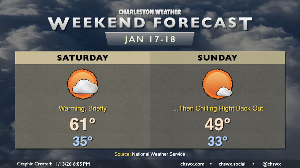
Saturday will offer a brief reprieve from the very chilly afternoon high temperatures as southwesterly winds ahead of a cold front send temperatures to the low 60s. As you might have deduced, though, the aforementioned front comes through Sunday, sending lows back down to the low 30s and perhaps keeping high temperatures from breaching 50°. This chill hangs around to start the new work week, with freezing temperatures each morning through at least Tuesday.
Follow my Charleston Weather updates on Mastodon, Bluesky, Instagram, Facebook, or directly in a feed reader. Do you like what you see here? Please consider supporting my independent, hype-averse weather journalism and become a supporter on Patreon for a broader look at all things #chswx!