Rest of the work week: Turning warmer before a potentially messy weekend
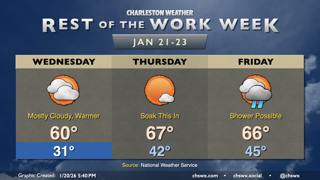
Temperatures will warm up for the second half of the week ahead of what is shaping up to be a rather messy weekend, with the risk for winter weather increasing especially away from the coast.
Wednesday will be the last subfreezing start for a few days, at least, with lows dipping into the upper 20s to low 30s before winds go more onshore, allowing temperatures to warm to around 60° in the afternoon — right at normal for this point in January. There will be a mix of sun and clouds as a coastal trough takes shape, but rain is not expected. Prefrontal warmth will peak on Thursday, with above-normal temperatures expected as lows in the low 40s warm to the mid-to-upper 60s in the afternoon with plenty of sunshine. We’ll start to see a risk for a few showers on Friday as the storm system begins to take shape and push a cold front into the area. Temperatures Friday remain on the warm side of normal, with highs in the mid-60s after a start in the mid-40s expected.
Latest on the weekend winter weather threat
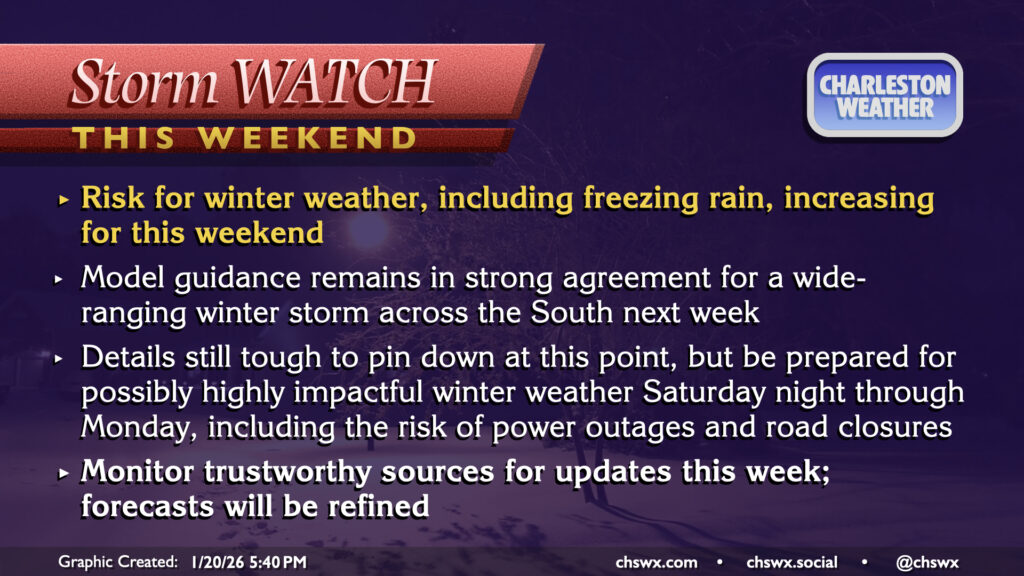
Data continues to pour in ahead of what looks to be a fairly widespread and impactful winter storm for much of the South into the Mid-Atlantic states for this weekend. Winter weather impacts are increasingly looking likely for our neck of the woods — especially for folks that are further north and inland — but the degree of those impacts and timing remain open questions with some continued disagreements in the model guidance as far as how far south subfreezing air can penetrate and how long precipitation lasts. For now, though, we should be getting ready for some travel disruptions as we head into the Saturday night through Monday morning timeframe, which is the most likely window for winter weather to occur. Unfortunately, the setup continues to favor freezing rain as the primary mode of winter weather, though some sleet may mix in as well. (We’ll be too far south for snow as warmer air aloft will continue to nose in for the duration of the event.) Continue to monitor forecast updates from trustworthy sources as we get closer to the weekend and can start to fine-tune more of the details on what we can expect.
Follow my Charleston Weather updates on Mastodon, Bluesky, Instagram, Facebook, or directly in a feed reader. Do you like what you see here? Please consider supporting my independent, hype-averse weather journalism and become a supporter on Patreon for a broader look at all things #chswx!