Tonight & Sunday: Light glaze of ice expected inland giving way to showers and storms in the evening
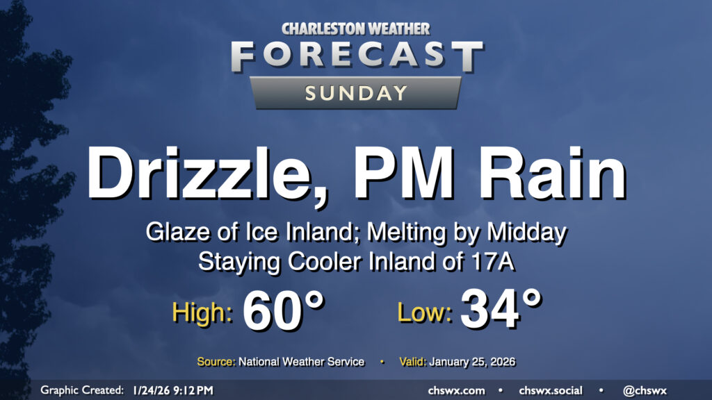
Cooler air will continue to overspread the area tonight, and warm air overrunning the shallow layer of cold air could help to generate some freezing rain or drizzle generally inland of 17-A overnight into tomorrow morning. Folks in inland Berkeley and Dorchester counties remain under a Winter Weather Advisory until 1PM Sunday for this threat. The main concerns will be a glaze of ice on elevated surfaces, perhaps including bridges and overpasses. It continues to appear that we should stay liquid in Charleston County, especially near the coast, so no Ravalanche redux is expected this go-around. As NWS put it in a briefing call this evening, this is a nuisance event rather than a more impactful event.
Any ice that does form will melt during the day as we should see temperatures creep above freezing across much of the area. A more pronounced warming is likely to take place as a warm front lifts northward across the area later Sunday, though it remains to be seen just how far north the warm front can erode the strong wedge of high pressure that’ll be in place. It’s possible that some of us further inland could be stuck in the 30s while we warm to near 60° near the coast in the afternoon and evening. From there. a band of showers and perhaps even a few thunderstorms will sweep through the area later Sunday evening into early Monday morning. Then, a cold front sweeps through the area by daybreak Monday, and sets the stage for a very cold final week of January.