Rest of tonight and Sunday: Snow tapers off, bitter cold awaits
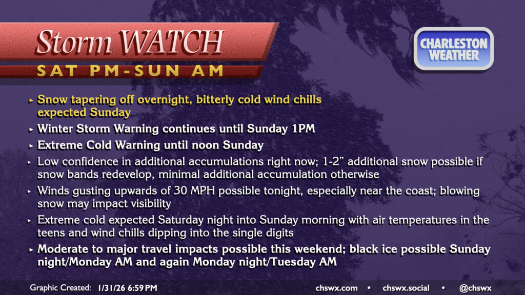
So far today, snow totals have come in a little under what was first expected for this phase of the event thanks to some dry air intrusion, and this trend right now looks to continue. The upper low which has been driving our snowfall will continue to lumber across the area tonight, and there remains the possibility for some additional bursts of snow to develop, though those opportunities will become increasingly rare as the night wears on. Latest guidance suggests that any remaining snowfall should scour out by 4-5 AM as drier air gets pulled in behind the departing coastal low. With gusts increasing to potentially 30 MPH, especially near and at the coast, there will be a risk for some of that light, fluffy snow to blow around and impede visibilities. Honestly, just best to stay in tonight if you can help it.
From here, temperatures become the main story. Very cold air will continue to blow into the area, and temperatures should fall into the teens in many spots, with low 20s elsewhere near the coast. With sustained winds 10-15 MPH and gusts upwards of 25 MPH continuing through Sunday morning, wind chills should drop solidly into the single digits, which is very rare air for this part of the world. Thus, the Extreme Cold Warning will continue through noon Sunday. If you are headed out and about, bundle up with plenty of layers — this is not your typical early February cold weather!
Temperatures Sunday should just get above freezing with plenty of sunshine expected, which should promote some melting of snow. However, the snowmelt will refreeze overnight as temperatures tumble back toward the upper teens to low 20s, introducing a black ice risk for Sunday night and Monday morning. It seems conceivable that the black ice risk could extend to a second day Monday night into Tuesday, but we will see what ultimately ends up happening with the snowpack.
Follow my Charleston Weather updates on Mastodon, Bluesky, Instagram, Facebook, or directly in a feed reader. Do you like what you see here? Please consider supporting my independent, hype-averse weather journalism and become a supporter on Patreon for a broader look at all things #chswx!