Weekend forecast: A couple more chilly days, then a reprieve
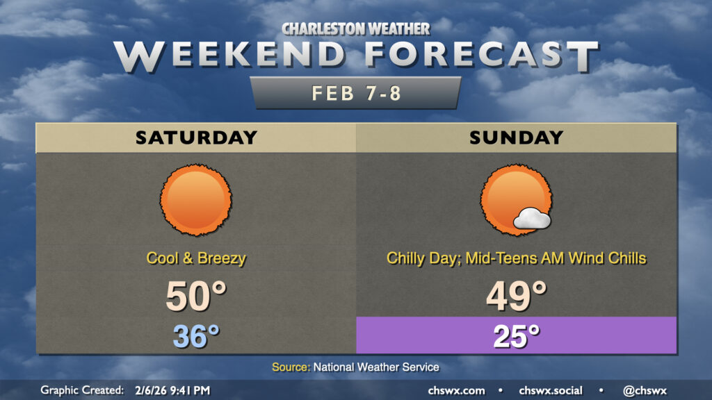
A chilly — but, thankfully, mostly sunny — weekend lies ahead as a reinforcing shot of cool air works its way in on Saturday. We’ll start Saturday in the mid-30s, but somewhat brisk northwesterly winds will drive the wind chill into the upper 20s to low 30s. Another push of cooler and drier air moves in during the day, and highs will only peak around 50° as a result with brisk winds continuing. Gusts to 25 MPH will be possible during the day, so keep that in mind for any outdoor activity you’ve got planned.
Temperatures plummet to the low-to-mid-20s on Sunday morning, with wind chills likely falling to the mid-teens. This should prompt a Cold Weather Advisory from the National Weather Service if this forecast holds. Mostly sunny skies will prevail, but highs will only peak in the upper 40s to low 50s once again. A warm front will lift north later in the day which will add a little cloud cover, but it won’t stop us from another chilly night Sunday night.
Heading into next week, though, we’ll find quite a reprieve from the recent cold snap: expect highs in the low 60s on Monday followed by upper 60s on Tuesday. 70s look like Wednesday before we start cooling off a bit heading into the weekend.
Follow my Charleston Weather updates on Mastodon, Bluesky, Instagram, Facebook, or directly in a feed reader. Do you like what you see here? Please consider supporting my independent, hype-averse weather journalism and become a supporter on Patreon for a broader look at all things #chswx!