Friday & the weekend: Warming up, but turning unsettled on Sunday
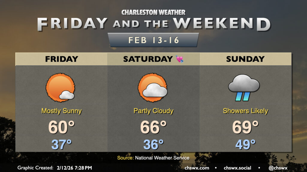
Another quiet and generally seasonably pleasant day is head on Friday. We get off to a bit of a chilly start as lows fall to the mid-to-upper 30s in the morning. A northeasterly breeze will make it feel closer to freezing to start the day, but temperatures will warm to around 60° in the afternoon under predominantly sunny skies. This is a few degrees below mid-February norms, but nothing too outrageous.
The weekend is a mixed bag. A warming trend will commence Saturday, as we start to see high pressure slip away, turning winds more southeasterly. Lows on Saturday drop to the mid-30s one more time, but highs will peak a few degrees above normal during the afternoon, generally topping out in the mid-60s. Clouds will be on the increase throughout the day as a storm system begins to approach from the west, but we should still see plenty of sun.
Alas, Sunday will not quite live up to its name as low pressure drags a cold front through the area. Models still differ a bit as far as the placement of said low pressure, but all in all, expect an increasingly unsettled day (though it may not rain all day, either). The best chance for the heaviest rains will arrive later in the evening hours with the front itself, and we could even hear a few rumbles of thunder. Severe weather is not expected this far north, though, given meager instability at best. Temperatures Sunday will run warmer than normal as we’ll be in the storm system’s warm sector; expect lows in the upper 40s to near 50° to warm to near 70° in the afternoon despite the rain and cloud cover.
Follow my Charleston Weather updates on Mastodon, Bluesky, Instagram, Facebook, or directly in a feed reader. Do you like what you see here? Please consider supporting my independent, hype-averse weather journalism and become a supporter on Patreon for a broader look at all things #chswx!