Tuesday: One more chilly day
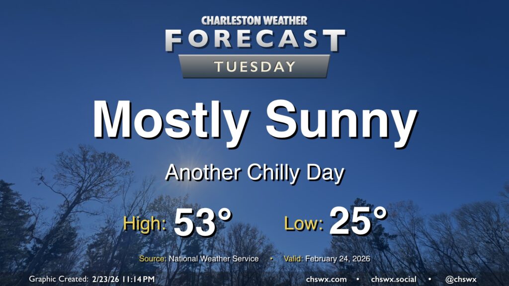
Our cold snap continues Tuesday as lows bottom out in the mid-20s in the morning. Winds will remain a touch elevated with the lingering pressure gradient between the high to our west and the nor’easter pulling away from New England, so wind chills will be a factor, perhaps briefly dipping into the teens (but not long enough for a Cold Weather Advisory, per NWS). Temperatures will run a few degrees warmer than they did on Monday, but that’s not saying much as Monday’s high only peaked around 48°. We can at least expect another day of mostly sunny skies with the cool and dry airmass still in place. Temperatures turn back up starting Wednesday as a cold front approaches the area; we should be in the 70s again by Thursday, and shower chances return for Friday.