Rest of the work week: Late-May weather in early March ramps up
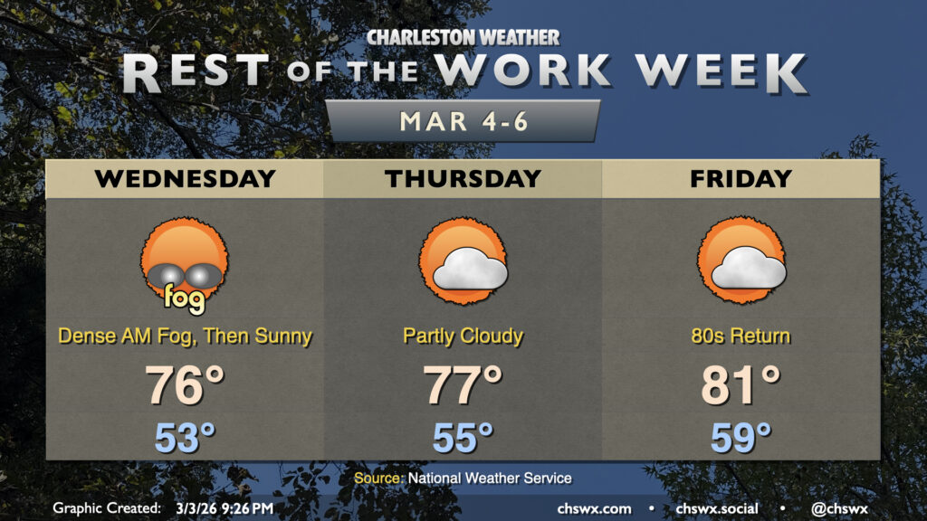
Generally quiet and rather warm weather continues for the rest of the work week. Wednesday morning will likely get off to a foggy start, with dense fog potentially reducing visibility to less than a quarter-mile at times. Use low beams and plenty of following distance in case you do encounter fog. Fog should erode by mid-morning, and we’ll head into the mid-70s under mostly sunny skies in the afternoon.
High pressure at the surface and aloft keeps quiet and increasingly warm weather in place for Thursday and Friday. Temperatures Thursday peak in the upper 70s, while we should get into the low 80s Friday morning. Fog may continue to be a concern, particularly in the mornings over land and perhaps even longer over the coastal waters where the cooler shelf waters will keep temperatures much cooler and closer to the dewpoint. (This will also keep the beaches much cooler, too.) This warm weather continues through the weekend and well into next week, too, as stacked high pressure remains largely in place.
Right now it doesn’t look like any record highs will fall, but we will get a bit close on Friday; the NWS forecast is 81° and the record high is 85° set in 1976. Temperature records for Saturday and Sunday look to stay intact as well.
Follow my Charleston Weather updates on Mastodon, Bluesky, Instagram, Facebook, or directly in a feed reader. Do you like what you see here? Please consider supporting my independent, hype-averse weather journalism and become a supporter on Patreon for a broader look at all things #chswx!