Friday & the weekend: Brief cooldown, then turning warmer and more unsettled
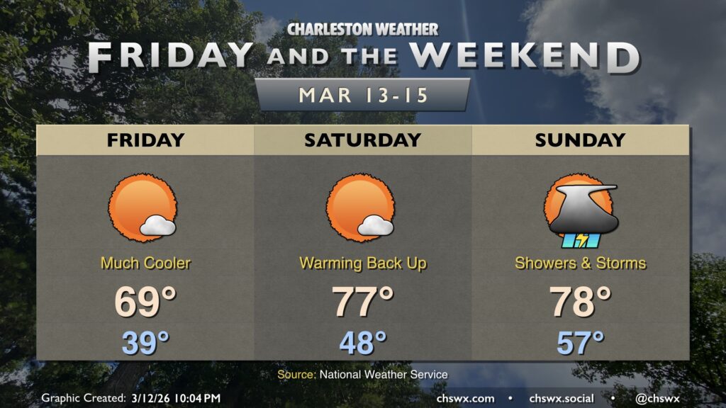
Friday will feel a lot different than much of the past week has, courtesy of a cold front that came through and put a chill back in the air Thursday afternoon and evening. Temperatures Friday start in the 30s across much of the metro away from the immediate coast, warming to the upper 60s to around 70° in the afternoon under mostly sunny skies. These high temperatures are much more in line with what we should normally see in mid-March.
The cooldown doesn’t last terribly long, though, as temperatures spike back up for Saturday. Expect lows in the upper 40s — some 10° warmer than Friday’s — with temperatures warming into the mid-to-upper 70s in the afternoon with plenty of sunshine again. No weather concerns for any outdoor St. Patrick’s festivities on Saturday as it should be a rather nice day.
The next front — a much more potent one — begins to affect the area on Sunday. Shower chances increase throughout the day, and a few thunderstorms will be possible particularly late. Lows take another near-10° jump over the previous day, with the morning starting in the mid-to-upper 50s before warming to the upper 70s in the afternoon. The best shower and storm chances will come during the afternoon and evening hours, lasting well into Monday as the front comes by, bringing with it the potential for some stronger or even severe thunderstorms before it clears the area later in the day.
After the front passes by Monday, we can expect another sharper cooldown for the middle of next week, which may include frost and freeze concerns for Monday and Tuesday nights. (So it goes in the transitional seasons.)