Weekend forecast: Saturday looks good, Sunday more unsettled
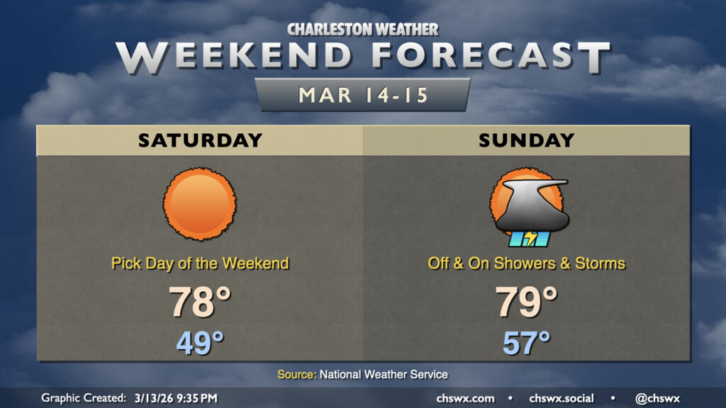
A bifurcated weekend of weather awaits, with a gorgeous day ahead on Saturday followed by a more unsettled day on Sunday ahead of a cold front that could bring about some strong storms Monday.
High pressure will be moving offshore, but will still be influential enough to bring about a beautiful day across the Lowcountry for many St. Patrick’s Day observances this weekend. Temperatures start around 50°, warming to the upper 70s in the afternoon with plenty of sunshine to be had.
Changes begin Sunday as a cold front draws steadily closer. Moisture will be increasing throughout the day, and we should see showers develop generally from south to north as the day goes on. It won’t rain all day in any one location, but it’ll be enough to where you’ll want backup plans for any outdoor activities. Lows will run considerably warmer — think mid-to-upper 50s — with highs peaking in the upper 70s to near 80° in the afternoon.
Strong to severe storms possible on Monday
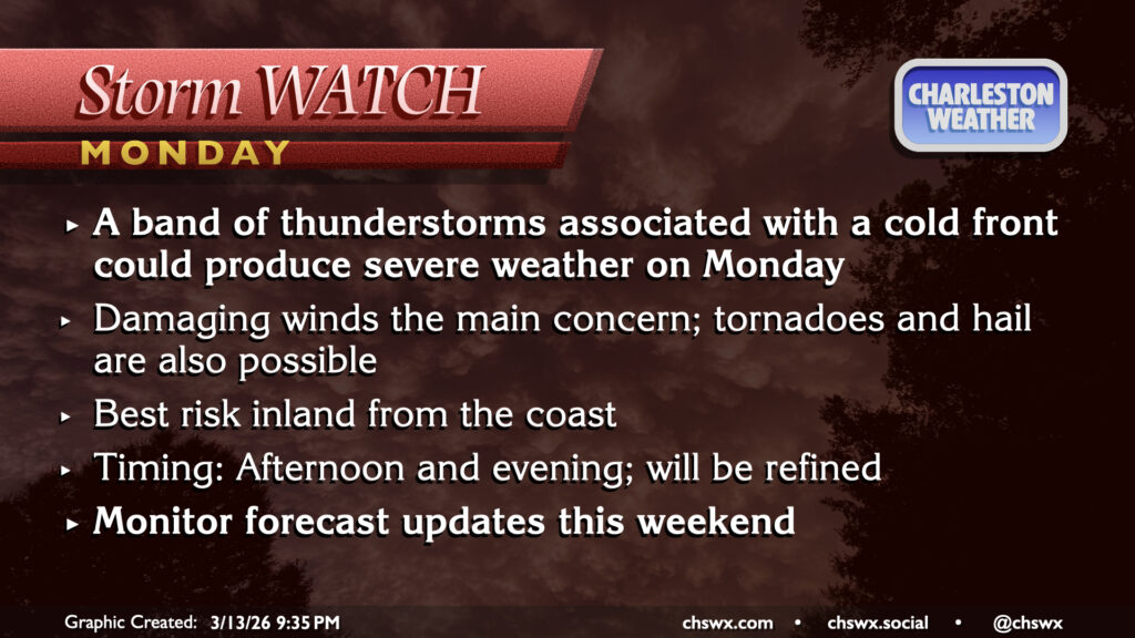
The aforementioned cold front will get into the area on Monday at the same time as a very deep mid-level trough, which will pump in plenty of moisture and strong winds aloft. This will create a shear and instability profile capable of producing some severe weather as a line of thunderstorms marches through. Damaging winds seem to be the main concern, but tornadoes and hail will be possible as well. The front itself should sweep offshore after sunset, shutting off not only the severe weather threat but also the heat pump, sending the subsequent few days back to more of a January feel.
Monitor forecast updates this weekend as more data comes in and the details can be refined.
Follow my Charleston Weather updates on Mastodon, Bluesky, Instagram, Facebook, or directly in a feed reader. Do you like what you see here? Please consider supporting my independent, hype-averse weather journalism and become a supporter on Patreon for a broader look at all things #chswx!