Rest of the work week: Frosty start Wednesday, but warming thereafter
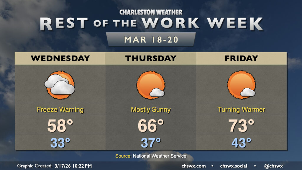
Quiet weather continues for the rest of the work week with high pressure in control. Wednesday gets off to a very chilly start with Freeze Warnings in effect as temperatures fall into the low 30s in the metro with perhaps some upper 20s further inland. Where temperatures don’t fall below freezing, frost will be a concern with mostly clear skies, so everyone should protect plants. Wednesday will remain much cooler than normal for mid-March with highs only peaking in the upper 50s. Clouds will be on the increase throughout the day but there are no concerns for any precipitation.
Thursday will start on a chilly note with one more round of frost and freeze concerns possible generally inland. From there, though, we begin to warm noticeably; highs Thursday peak in the mid-60s under mostly sunny skies. The warming trend continues Friday as lows in the low-to-mid-40s warm to the low-to-mid-70s with plenty of sunshine to be had. This continues into the weekend, too, when 80s are set to return to the forecast.
Follow my Charleston Weather updates on Mastodon, Bluesky, Instagram, Facebook, or directly in a feed reader. Do you like what you see here? Please consider supporting my independent, hype-averse weather journalism and become a supporter on Patreon for a broader look at all things #chswx!