The week ahead: The temperature rollercoaster gets especially topsy-turvy
The last full week of March promises quite a big swing in temperatures from seemingly day to day as a series of fronts affect the area. We’ll have a few shots at showers, too, but they don’t look likely to offer much in the way of drought relief.
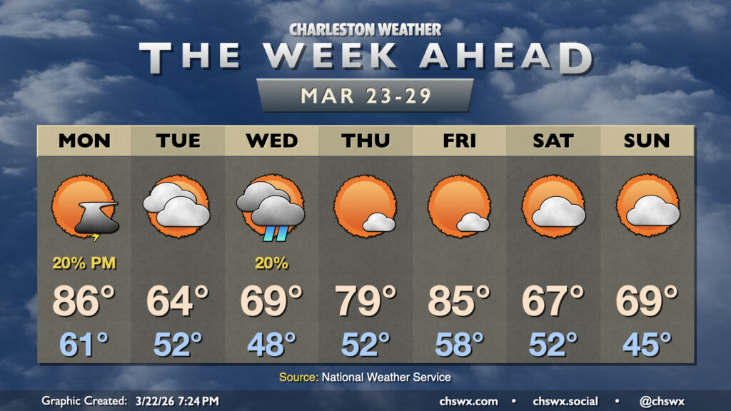
After Sunday’s high of 88° tied the record high first set in 2011, we have another very warm day on tap for Monday, which may once again challenge high temperature records. Monday starts in the low 60s — well above mid-to-late March normals — and warms to the mid-to-upper 80s in the afternoon. The record high of 87°, set in 1995, is certainly within reach. (It should run a few degrees cooler near the coast.)
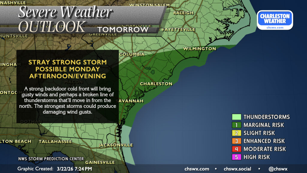
Later Monday, we’ll want to keep an eye on the skies to our north for the potential for a band of thunderstorms to develop along a backdoor cold front that’ll be heading our direction. The atmosphere looks supportive of a few sporadic damaging wind gusts if in fact storms can fire and maintain themselves. One limiting factor will be the arrival time, which may run closer to the evening and thus limit the severe threat somewhat as peak heating will be over. Regardless, this may become a commute-time issue, so be alert for rapidly changing conditions and be ready to slow things down a bit.
From there, we have a couple cloudy and much cooler days ahead as high pressure wedges southward over the area from the northeast. Tuesday will be really noticeable, with lows in the low 50s warming to the mid-60s in the afternoon (not too far off from Monday’s low!) and more cloud cover than not. A few showers are possible late Tuesday into early Wednesday as a coastal trough takes shape, but otherwise, it’ll be mostly cloudy and cool. Temperatures on Wednesday will begin to moderate as the wedge starts to weaken, with highs approaching 70° after starting the day in the upper 40s.
The mercury lurches upward on Thursday and Friday as we will be between fronts. Temperatures Thursday start in the low 50s, but will warm to the upper 70s to near 80°. We’ll be back on record high watch for Friday as temperatures will be peaking in the mid-80s; the record of 87° set in 2021 is potentially achievable. Seasons then seemingly flip again as another front gets through overnight Friday into Saturday, sending temperatures back to the 60s and cloud cover up another notch once again. That’s March, baby.
Follow my Charleston Weather updates on Mastodon, Bluesky, Instagram, Facebook, or directly in a feed reader. Do you like what you see here? Please consider supporting my independent, hype-averse weather journalism and become a supporter on Patreon for a broader look at all things #chswx!