Rest of the work week: Warming back up, with a record high possible Friday; much cooler for Bridge Run
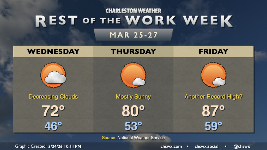
As expected, Tuesday was quite the dreary, cool day. We set the daily highs at both downtown and North Charleston after midnight, with the preliminary daily low of 53° being set in the afternoon as of the 5PM climate report. (This will get cooler — as of this writing, it’s 52° at the airport.) We begin to see signs of recovery on Wednesday, though, as the high pressure wedge weakens and scours out, allowing progressively more sunshine through during the day. Expect lows in the mid-40s to warm to the low 70s in the afternoon — basically right on target for this point in the year.
From there, the 80s return to close out the work week. Temperatures Thursday will peak right around 80° with plenty of sunshine to be had, while we may challenge another record high on Friday. The forecast high of 87° would tie the record set in 2020 and 2021 if it verifies, and it’s not out of the question that we could go even higher.
Bridge Run: Turning sharply cooler once again
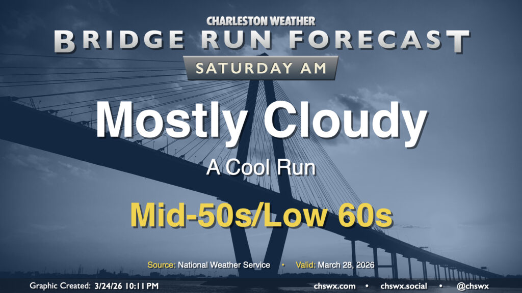
By Bridge Run morning, though, the bottom will once again fall out of the mercury, and temperatures will drop into the mid-50s to low 60s for the race. Highs Saturday will only peak in the mid-to-upper 60s as another high pressure wedge takes shape, so be ready for a bit of a cool post-race afternoon out and about downtown (if that’s your plan, anyway).
Follow my Charleston Weather updates on Mastodon, Bluesky, Instagram, Facebook, or directly in a feed reader. Do you like what you see here? Please consider supporting my independent, hype-averse weather journalism and become a supporter on Patreon for a broader look at all things #chswx!