Friday & the weekend: Warmer-than-normal temperatures persist with a few showers
Warmer-than-normal temperatures will continue for a few more days across the Lowcountry before a sharp front cools us off to start the first full week of April.
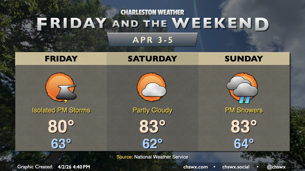
Friday will once again start in the low-to-mid-60s, warming to around 80° in the afternoon with the potential for a few showers and maybe even a thunderstorm in the afternoon as onshore flow continues. Most of us stay dry, though. Saturday should stay generally partly cloudy with temperatures running a little warmer in the afternoon, perhaps heading into the mid-80s. We should do that again Sunday, though an advancing front will drive rain chances a little higher as we get into the afternoon and evening hours. We’ll get a little rain out of it, but don’t count on much, with about a half-inch tops in some spots. It definitely won’t be enough to bust the ongoing severe drought in the Lowcountry.
Sunday’s front will cool us off quite a bit for Monday and beyond, with a risk for unsettled weather (and, quite frankly, much needed rain) continuing into the middle of next week. Temperatures will run at or a little below normal for this point in April.
Follow my Charleston Weather updates on Mastodon, Bluesky, Instagram, Facebook, or directly in a feed reader. Do you like what you see here? Please consider supporting my independent, hype-averse weather journalism and become a supporter on Patreon for a broader look at all things #chswx!