Rest of the work week: Chilly and breezy Wednesday, then warming up
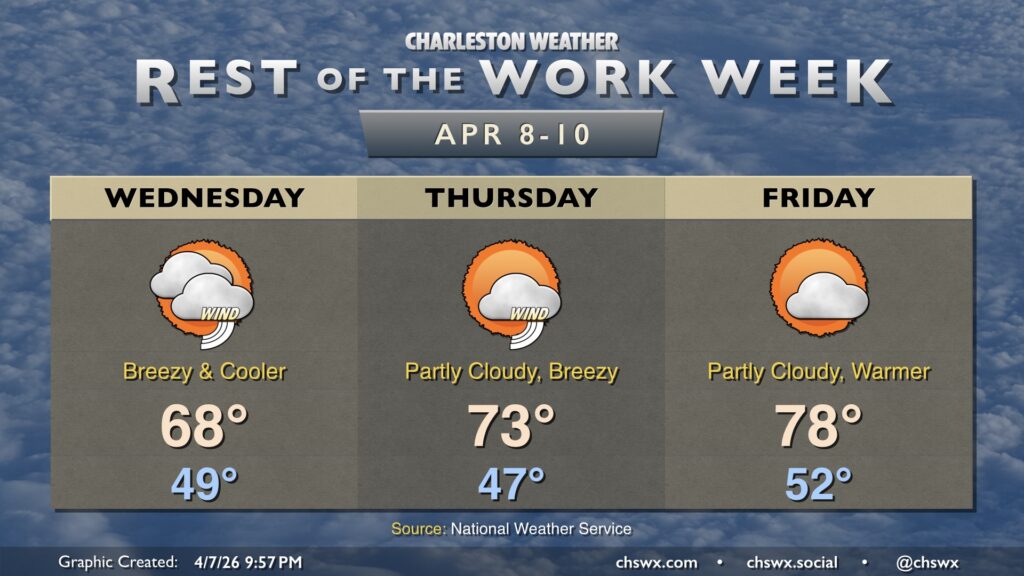
A reinforcing front will push through tonight, bringing us cooler and breezy weather for Wednesday. We start Hump Day in the upper 40s to around 50°, warming to just the upper 60s in the afternoon with a mix of sun and clouds. It’s going to be a breezy day, too, with winds 15-20 MPH gusting to 30-35 MPH. This combined with dry air will increase the fire danger for Wednesday. The northeasterly winds also increase the rip current and high surf risk, with a High Surf Advisory in effect for Wednesday into much of Thursday.
We will start to see temperatures warm as we get into the latter part of the work week. Temperatures Thursday head into the low 70s, and the upper 70s return for Friday as the cool high pressure wedge from Wednesday erodes. Breezy conditions continue Thursday, and there may even be a stray shower near the coast as a coastal trough takes shape. By Friday, though, we’ll see much more sunshine. That’ll continue into the weekend, too, with temperatures heading back into the low 80s.