Weekend forecast: Hot Saturday, turning slightly cooler on Sunday
After tying a record high on Friday, we’ll make another run at one on Saturday before a cold front ushers in some changes starting Sunday.
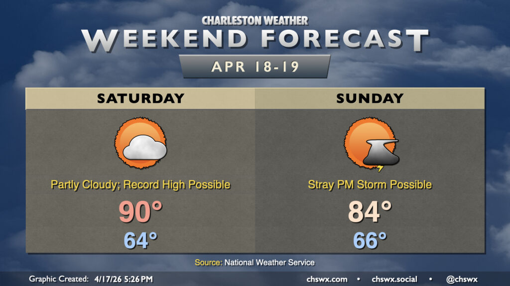
First, though, we’ve got another warm day on Saturday as high pressure hangs on for one more day at the surface and aloft. Lows in the mid-60s warm to around 90° away from the coast, which will run a little cooler — certainly worth keeping in mind if the beach is in your plans tomorrow. Skies will generally be partly cloudy with winds out of the south around 10 MPH. We could see a little coastal flooding late Saturday as the new moon approaches perigee with some salt water on the most vulnerable roads downtown, but major issues are not expected.
Changes are inbound for Sunday as a cold front approaches. Another warm start in the mid-60s will yield to temperatures in the low 80s ahead of the front. Moisture is scarce, but the front could eke out a stray shower or storm. Whatever rain falls won’t be terribly much, though, and your expectation should be that the sprinklers will need to keep on keeping on. The front will knock temperatures down to start the new work week, though mid-80s return by next Thursday.
Due to the drought, a statewide burn ban is in effect until further notice from the South Carolina Forestry Commission. Grilling out is okay; a bonfire is not. Regardless, be safe and smart!
Follow my Charleston Weather updates on Mastodon, Bluesky, Instagram, Facebook, or directly in a feed reader. Do you like what you see here? Please consider supporting my independent, hype-averse weather journalism and become a supporter on Patreon for a broader look at all things #chswx!