The week ahead: A few more rain chances, not quite as warm
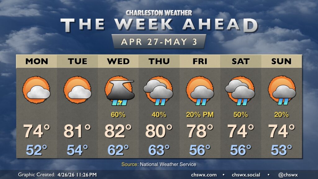
One of the driest Aprils on record will come to a somewhat unsettled end this week as the pattern starts to finally flip toward something a little more favorable for rain chances. We’ll run a little cooler, too, especially as we start May.
But first, a fairly pleasant Monday is in store as high pressure briefly wedges southwestward across the area. Expect a bit of a cloudy start to give way to more sunshine throughout the day. The northeasterly flow within the wedge will keep temperatures a little below normal for late April, with highs peaking in the mid-70s after starting the day in the mid-50s. Fire danger will be elevated a bit on Monday, with drier air and a bit of a breezy day on tap combined with the ongoing severe to extreme drought. The statewide burning ban remains in effect — please heed it!
The only other issue that could creep up Monday may be some minor tidal flooding with the 6:12 PM high tide, courtesy of the northeasterly winds and upcoming full moon. Watch for the potential for some closed roads and keep an ear out for advisories from the National Weather Service.
A warming trend takes hold Tuesday through midweek. While Tuesday remains dry, a series of disturbances begins to affect the area Wednesday and Thursday, bringing about more chances for some much-needed rain, especially Wednesday. Another surface front comes by later Thursday, which will knock temperatures down for the weekend. Troughing aloft will continue to allow some disturbances to ripple through, with slight shower chances persisting through the weekend.