Rest of the work week: An unsettled end to a dry April
We will close a bone-dry April out with a couple more chances for showers and thunderstorms as another cold front approaches the area with disturbances riding along it. One such disturbance fell apart as it reached the Lowcountry today, giving us another trace of rain at the airport. Officially, though, rainfall totals for the month of April remain at 0.01”, which currently ties 1972 as the driest April on record. With any luck, though, we should not end up there, though a top-five driest April on record certainly appears to be in the cards.
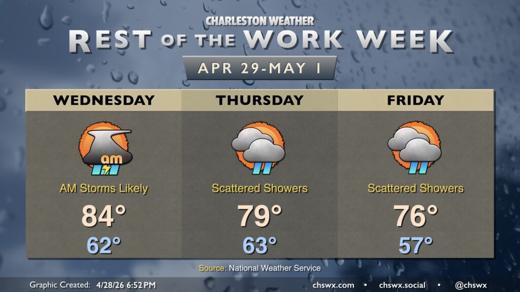
Wednesday’s aforementioned disturbance looks pegged to start to affect the area perhaps as early as the 7-8am timeframe, with the best chances of rain arriving between then and noon. The disturbance will once again encounter decreasing moisture and will be in a weakening phase, but a few thunderstorms can’t be ruled out in addition to some rain showers. Rainfall amounts should remain on the low side, though, with model consensus generally coming in around a tenth of an inch in most locations. A few showers will be possible as we get into the afternoon, but chances will be much lower.
Thursday will run a touch cooler in the afternoon with the front moving by. Once again, there will be a chance for some scattered shower or even thunderstorm activity, and once again, model guidance is not bullish on significant rainfall. Every bit helps, though, and we’ll take it.
The front stalls to our south, and another wave of low pressure riding along it may bring a few showers our way for Friday, but chances are generally on the low end. Temperatures will run even cooler than Thursday’s upper 70s, with temperatures topping out generally around the mid-70s.