Friday & the weekend: Stormy start, then getting a little quieter
Unsettled weather continues as the remnants of short-lived Tropical Storm Arthur move across GA and South Carolina late tonight into early Friday. From there, more typical summertime weather sets in.
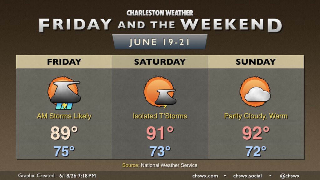
Friday morning could be a little rambunctious with a band of thunderstorms associated with the remnants of Arthur moving through. A few strong to severe thunderstorms cannot be totally ruled out, with damaging wind gusts the primary concern. Storms should clear the area by noon with mostly cloudy skies thereafter. Expect highs to recover to the upper 80s with heat indices pushing the upper 90s due to the very humid airmass in place. Some models suggest another batch of thunderstorms firing late in the evening as a front approaches the area, but we’ll see how that ultimately evolves (if it does at all).
Isolated thunderstorms will continue to be possible Saturday as the front stalls out nearby. It’ll begin to lift northward as a warm front during the day, and should be in NC by evening. Temperatures will run a touch warmer, with highs peaking in the low 90s. Relatively drier air will help keep heat indices from getting too out of hand, though.
A slot of drier air remains in place for Father’s Day, which will minimize the risk for afternoon showers and thunderstorms (though not every model is dry, either). Temperatures on Sunday will continue generally on the warm side of normal, with highs peaking in the low 90s once again after starting in the low 70s.