Weekend forecast: Hot start, unsettled finish
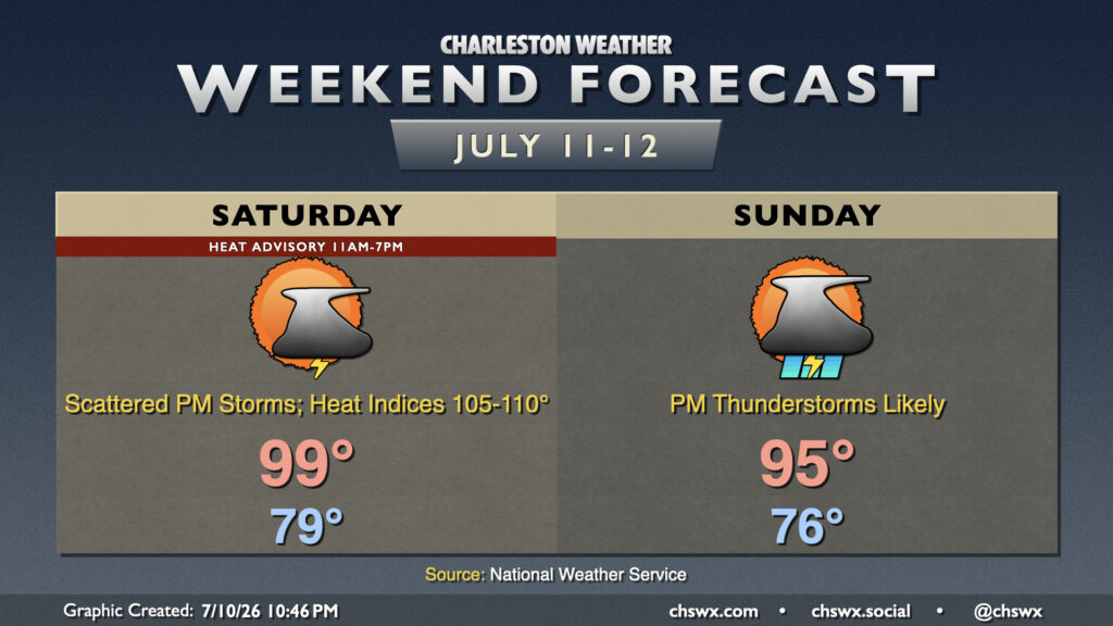
After another 99° day at the airport, we’ll take one more run at the century mark on Saturday before a front drops toward the area on Sunday, bringing about more unsettled weather that will keep temperatures a little more in check.
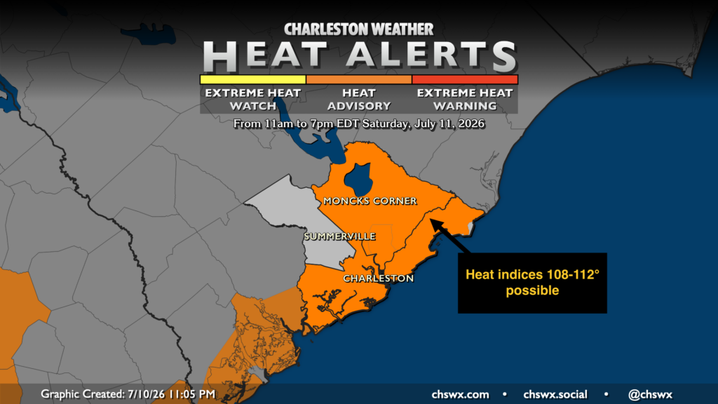
Slightly lower dewpoints courtesy of westerly winds will help break our string of three consecutive days of Extreme Heat Warnings at the coast. However, heat indices should still surge to 108-110° or so in the coastal corridor once the seabreeze starts pushing inland, prompting a Heat Advisory for Berkeley and Charleston counties from 11am-7pm. Air temperatures could get close to the century mark again before showers and thunderstorms begin to pop. Like the past few days, storms will be moving coastward and could intensify as they intersect the seabreeze, perhaps becoming capable of producing some damaging wind gusts. Heavy rain and frequent lightning will also be concerns once more. Like Friday, we’ll want to watch storms closely as we get toward high tide, which will be running higher thanks to the new moon.
Changes begin to arrive on Sunday as a front starts to approach the area. It’ll still be a hot day; highs peaking in the mid-90s are expected after another upper 70s to low 80s start. However, we should see thunderstorms initiate a little earlier in the afternoon as the front draws nearer, with storms turning somewhat widespread heading into Sunday evening. Once again, there will be a damaging wind and flooding rain threat from the strongest thunderstorms. We’ll also be paying attention to water levels in Charleston Harbor as they may reach the minor coastal flooding threshold of 7′ between 6-8 PM. If there’s heavy rain in the area, that could make the flooding situation worse, so any storms nearby will be worth watching carefully.
This will lead into an unsettled but cooler start to the week with highs just in the 80s on Monday and Tuesday. The respite will be short-lived, though, with low to mid-90s returning by midweek.
Follow my Charleston Weather updates on Mastodon, Bluesky, Instagram, Facebook, or directly in a feed reader. Do you like what you see here? Please consider supporting my independent, hype-averse weather journalism and become a supporter on Patreon for a broader look at all things #chswx!