Rest of the work week: A little more sun and turning warmer
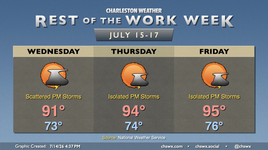
The pattern turns a little more settled as high pressure builds back in aloft. As a result, we will see more sunshine as the week progresses, though with that will come warmer temperatures, too, which could push Heat Advisory thresholds in spots.
Wednesday starts in the low-to-mid-70s, warming to the low 90s in the afternoon. High-resolution guidance is suggesting another round of showers and thunderstorms at the coast in the morning, diminishing by midday before the seabreeze kicks back off in the afternoon. Heavy rain will remain possible with any thunderstorms that develop, and an isolated risk for damaging wind gusts is not out of the question, either. Finally, there will be a risk for minor coastal flooding during the evening high tide, though it should not be as high as we are observing tonight.
Thursday and Friday should be a little quieter as high pressure ridging in aloft helps to suppress shower and thunderstorm development for the most part, though with surface dewpoints well into the 70s, a stray shower or storm can’t be totally ruled out. The main story will be the return of the heat as highs peak back into the mid-90s each afternoon. Mix in the dewpoints, and we may approach the heat advisory threshold of 108° heat indices once again closer to the coast (though this will still not be quite as extreme as last week’s heat). We’ll keep this going through the weekend and well into next week, with highs generally running a few ticks above normal.
Follow my Charleston Weather updates on Mastodon, Bluesky, Instagram, Facebook, or directly in a feed reader. Do you like what you see here? Please consider supporting my independent, hype-averse weather journalism and become a supporter on Patreon for a broader look at all things #chswx!