Rest of the work week: Warm and muggy conditions continue
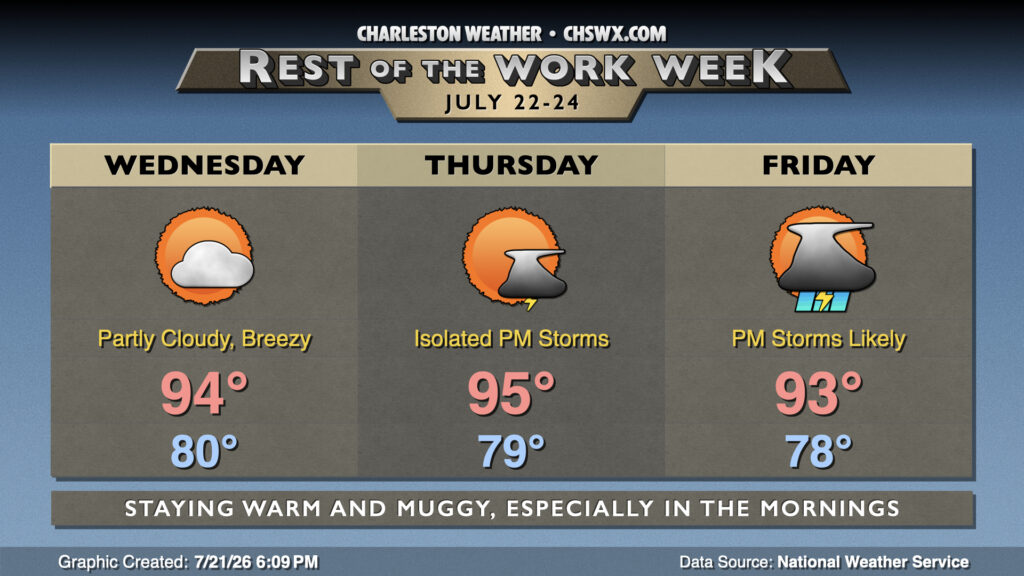
The weather story this week thus far has been the extremely warm and muggy mornings. This morning was no exception — downtown has, thus far, only dropped to 84° while the airport’s low is 80°. If these lows hold, they would break the record warm low temperature downtown and tie it at the airport. These warm lows will continue for the rest of the work week, which will not allow much relief from the mid-90s heat during the day.
Wednesday will likely not drop below 80° once again in much of the metro. This’ll lead to highs in the mid-90s in the afternoon away from the coast, where onshore flow should keep air temperatures in the upper 80s to around 90°. Dewpoints near the coast will run in the mid-70s, driving heat indices into the mid-100s. We should see a little mixing out of dewpoints, especially inland, that will keep heat indices in the low 100s — still plenty warm, but not terribly out of control. We should stay rain-free for much of the day, though a stray shower or storm is never totally out of the question this time of year.
Thursday stays on the warm side of normal, with lows once again around 80° and highs solidly in the mid-90s. There is a slightly better chance for a shower or thunderstorm in the afternoon and evening as a cold front approaches the area. That front increasingly looks like it will stall to our north, keeping temperatures pretty warm while turning shower and storm coverage more scattered than they might have been as we head into Friday and the weekend. A few of us could still see some heavy downpours and strong thunderstorms, though.
Follow my Charleston Weather updates on Mastodon, Bluesky, Instagram, Facebook, or directly in a feed reader. Do you like what you see here? Please consider supporting my independent, hype-averse weather journalism and become a supporter on Patreon for a broader look at all things #chswx!