Tuesday: Heat indices soar again into heat advisory criteria
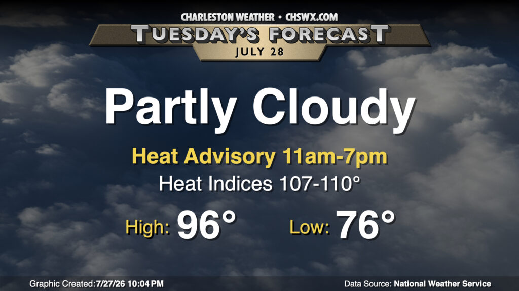
High heat returns to the Lowcountry on Tuesday as southwest winds pump plenty of warm and humid air into the area. We start in the mid-70s inland and upper 70s downtown and at the coast, and with plenty of sunshine, we’ll warm to the mid-to-upper 90s. Dewpoints will run in the mid-70s inland, while they’ll be running in the upper 70s to near 80° at the coast and behind the seabreeze. This will drive heat indices into the upper 100s to low 110s during peak heating, spiking in the wake of the seabreeze as dewpoints surge. A Heat Advisory will go into effect at 11am, and will run through 7pm for the entire Tri-County area. Take frequent water and shade breaks if you’re working outside during the height of the day tomorrow. A stray storm or two can’t be totally ruled out, especially overnight as a front drives southeastward into the Midlands before stalling out.
Rest of the work week: Warm and humid Wednesday gives way to drier end of the month
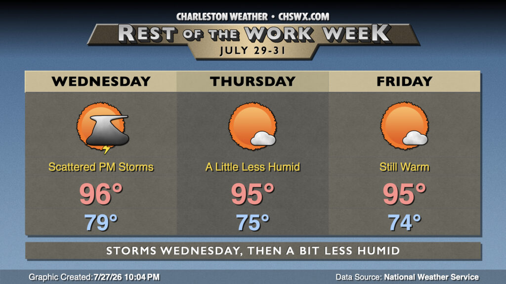
Another very warm and humid day is on tap for Wednesday as a stalled front hangs up just to our north, and it may lead to yet another Heat Advisory. However, there will be a better risk for showers and thunderstorms in the afternoon given the proximity of the front to add more in the way of lift. So, while heat indices should once again push 110° in the coastal corridor, we’ll see if they hang around long enough for the Heat Advisory criteria of 108°-112° for two or more hours to be satisfied.
The front will push through overnight Wednesday into Thursday. It won’t send us into fall — highs will continue to run in the mid-90s — but dewpoints should fall into the upper 60s, which will make it feel at least a little less humid as we close out what’s been a very warm July. With five days to go, the average temperature of 85.5° trails only 1986 and 2016 for the warmest July on record at North Charleston.
Follow my Charleston Weather updates on Mastodon, Bluesky, Instagram, Facebook, or directly in a feed reader. Do you like what you see here? Please consider supporting my independent, hype-averse weather journalism and become a supporter on Patreon for a broader look at all things #chswx!