The week ahead: Turning hotter and less stormy
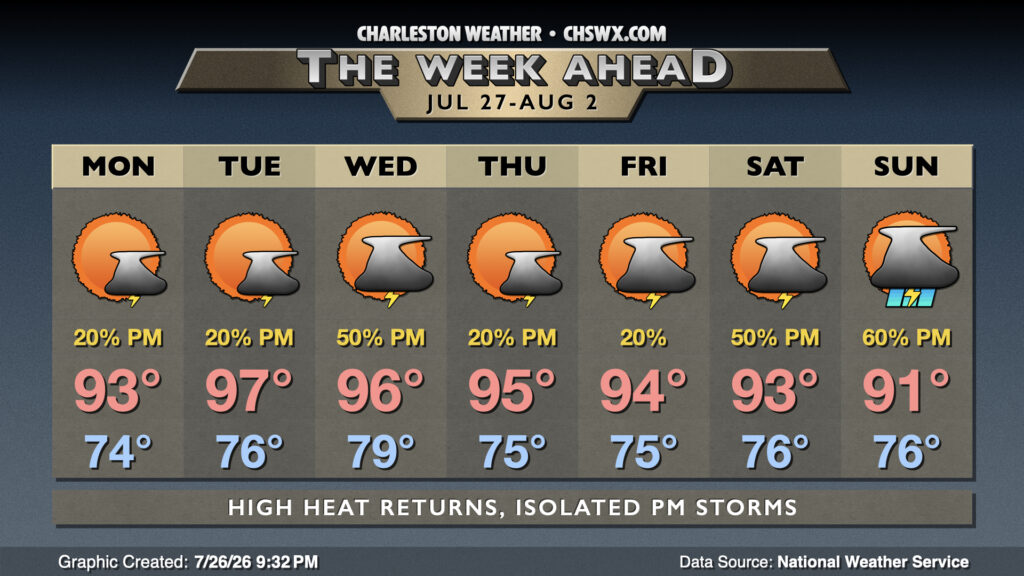
After a very wet weekend that included flooding rains at Mt. Pleasant and Isle of Palms, we should see a bit of a downtrend in rain chances as some of the deeper moisture that’s been hanging around this weekend moves offshore and further into the Atlantic. The pesky cold front that’s been hanging around will start the day just to our south, lifting north during the afternoon, so between this and the seabreeze, it’s still possible for a few afternoon thunderstorms to fire. Temperatures will run in the mid-70s Monday morning, topping out in the low to mid-90s in the afternoon. Heat indices should run around 102-106°, highest near the coast.
Heat will subsequently turn back up Tuesday and Wednesday before another front moves into the area for Thursday. We could see temperatures reach back into the mid-to-upper 90s, and with dewpoints in the mid-to-upper 70s, it’s conceivable that another round of Heat Advisories could be in store. A few storms will be possible each afternoon and evening, with the greater risk later on Wednesday as the front nudges closer.
Depending on where the front ends up Thursday, it’s possible slightly drier air may find a way in, but that won’t take the edge off highs in the mid-90s each day heading into the weekend. Any drier air will be short-lived, though, as moisture transport from the Gulf kicks right back into gear by Sunday, with deep moisture returning to the area and rain chances ticking up as a result.
Tropical update: Not much to write home about as we approach August
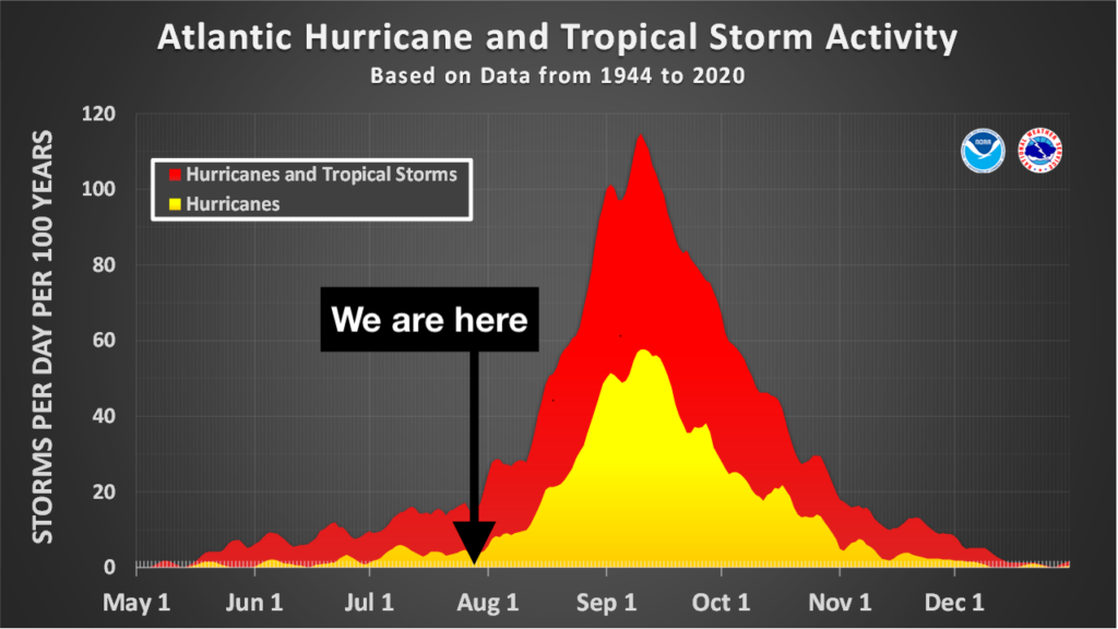
So far, this El Niño hurricane season is going about as expected: a couple short-lived, home-grown systems in the Gulf in Arthur and Bertha, with no areas of concern noted for the next week or so. Climatologically speaking, though, hurricane season tends to quickly ramp up in August on its way to the peak in mid-September, so we are far from being able to let our guard down with a bulk of the season’s activity yet to come. Stay tuned…
Follow my Charleston Weather updates on Mastodon, Bluesky, Instagram, Facebook, or directly in a feed reader. Do you like what you see here? Please consider supporting my independent, hype-averse weather journalism and become a supporter on Patreon for a broader look at all things #chswx!