Rest of the work week: Heat wave abates slightly before more unsettled weather arrives
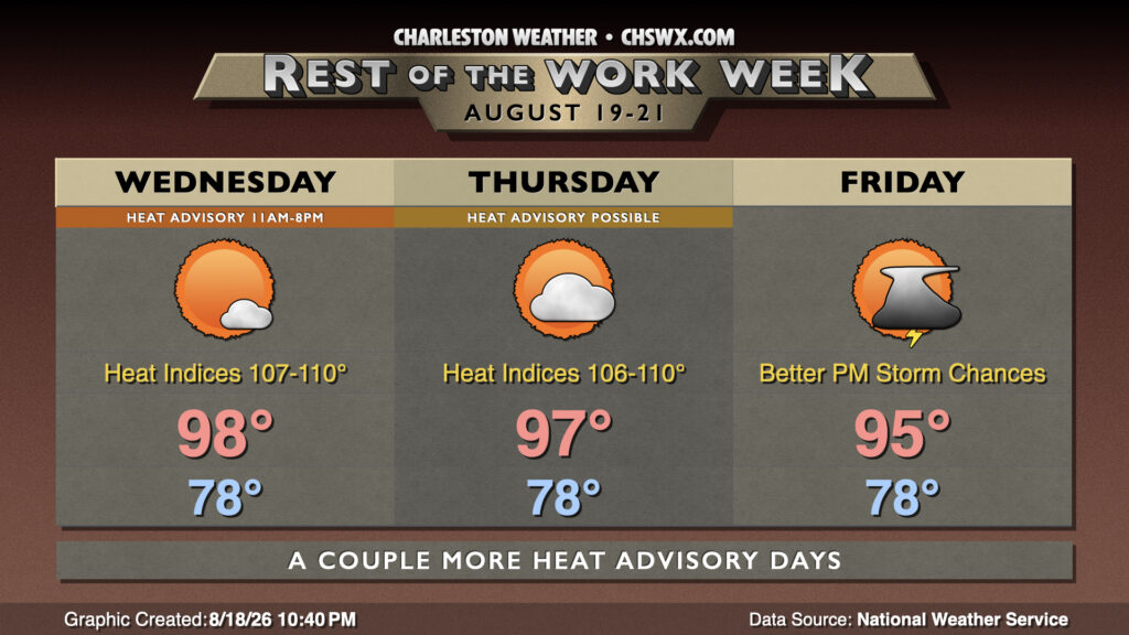
After reaching 99° again on Tuesday, we will start to see a a slow down-trend — though not necessarily an end — to the heat wave as we get through the second half of the work week and head toward the weekend.
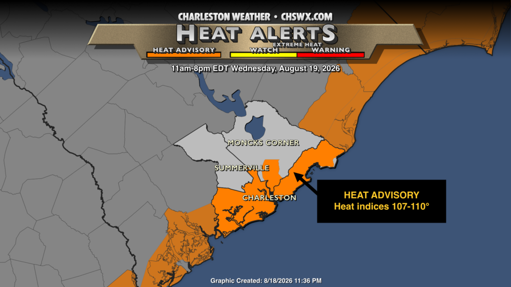
Heat Advisories continue for Wednesday, though they will be limited to Charleston County as well as Berkeley County heading up the Cooper (including Hanahan and Daniel Island). Heat indices here should peak between 107-110°. A weakening ridge aloft will allow for a bit more in the way of shower and thunderstorm activity in the afternoon, and that combined with a little more mixing out of the surface dewpoints should keep heat indices below advisory thresholds further inland, peaking generally in the 105-107° range. Given more than ample instability, a thunderstorm or two could turn strong to even severe with strong winds, heavy rain, and frequent lightning the main concerns. We’ll rinse and repeat this for Thursday before we start to see more substantive changes in the pattern beginning Friday as a front approaches the area. This front will help gradually induce more showers and thunderstorms, and that will help keep temperatures down a few more degrees. The “cooldown” isn’t much of one, though, as highs on Friday peak in the mid-90s once again.
Follow my Charleston Weather updates on Mastodon, Bluesky, Instagram, Facebook, or directly in a feed reader. Do you like what you see here? Please consider supporting my independent, hype-averse weather journalism and become a supporter on Patreon for a broader look at all things #chswx!