Friday & the weekend: Heat takes a break, but heavy rain is possible
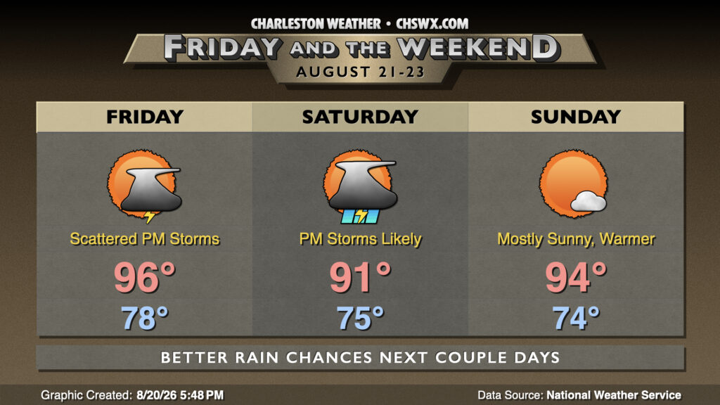
The hot pattern we have been stuck in for the better part of a week and a half finally begins to break down starting Friday, helping to temper some of the extreme heat that we’ve experienced while also allowing for more showers and thunderstorms, particularly Friday and Saturday.
As of this writing, there are no heat headlines in effect for Friday — the first time since August 11 that has been the case. It still looks like we will get pretty warm, though — highs in the mid-90s combined with mid-70s dewpoints will still run heat indices well into the 100s, with some isolated spikes of 110° possible. However, showers and thunderstorms should get off to an earlier start, and that in turn should limit the duration of the high heat. There’s still going to be plenty of moisture available, and that could induce some heavy rain and wet microbursts. The better coverage of showers and thunderstorms should take place along and inland of 17-A as the seabreeze pushes inland and interacts with a nearby trough.
More widespread showers and thunderstorms appear likely on Saturday as a front approaches the area from the west. It won’t rain all day, but rain will be possible pretty much at any point. The upside to this is that highs should not peak too far above 90° — something we haven’t been able to say lately! Once again, heavy rain with the potential for isolated flooding will be what to watch for.
We’ll get a break in the rain on Sunday as some drier air tries to encroach into the area. It should be a fairly sunny day with highs peaking in the low to mid-90s. Dewpoints will run a few degrees cooler than they have been as of late, and could even dip into the upper 60s inland — brief refreshment in the midst of what’s turned out to be a brutal summer, heat-wise. Unfortunately, it doesn’t last — the front falls apart to our west, and moisture surges back into the area next week.
Follow my Charleston Weather updates on Mastodon, Bluesky, Instagram, Facebook, or directly in a feed reader. Do you like what you see here? Please consider supporting my independent, hype-averse weather journalism and become a supporter on Patreon for a broader look at all things #chswx!