Rest of the work week: Gradually warming back to the 90s, afternoon storms
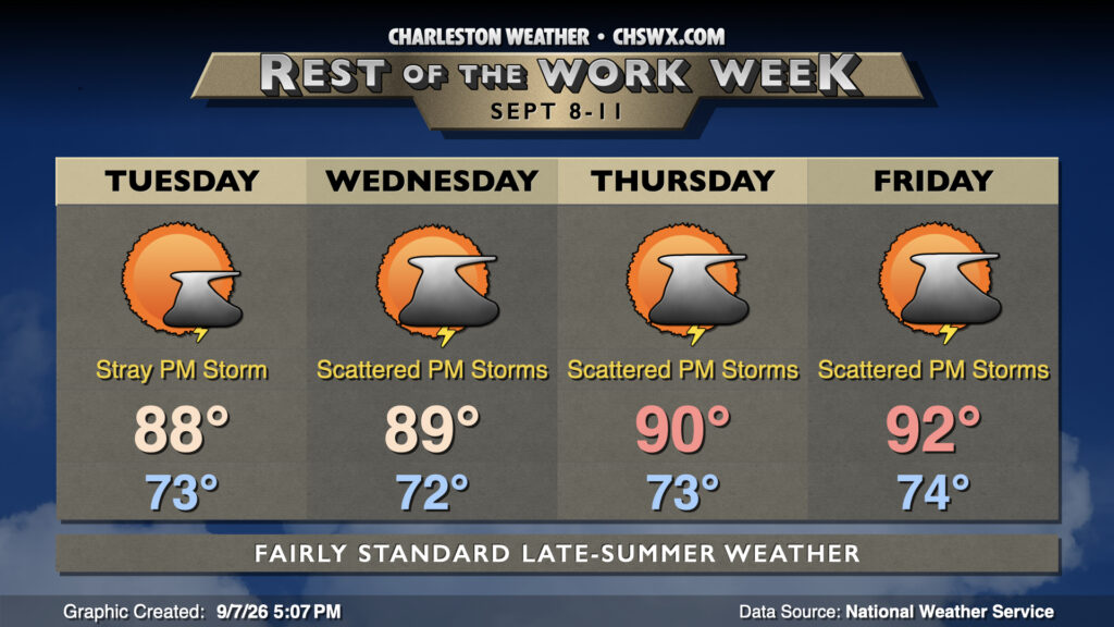
The abbreviated work week will feature gradually warming temperatures and chances for showers and thunderstorms each afternoon. We’ll also need to monitor the evening high tides for the potential for minor to moderate coastal flooding with the upcoming full moon.
At the surface, high pressure will remain in place for the next few days before another front starts to nudge toward the area on Friday. The area of high pressure will keep northeasterly winds blowing into the area, which will drive both a risk of coastal flooding and rip currents during the week. As for temperatures, we will see a warming trend heading toward Friday, as highs in the upper 80s on Tuesday gradually warm into the low 90s by the end of the week. Lows will generally run in the low-to-mid-70s, owing to the continued humid airmass in place. This airmass will help keep a risk for showers and thunderstorms in place each afternoon, with those chances ticking upward as we head toward the end of the week. Severe weather is not expected, but a few spots could still see some heavy rain, especially as deeper moisture works its way back in beginning Wednesday and lasting into the end of the week and the weekend.
As mentioned, there will be a coastal flooding risk each evening through at least Wednesday. Minor to moderate flooding around the evening high tides will be possible, and we can expect at least some road closures as a result. Keep an ear out for Coastal Flood Advisories from the National Weather Service.
Follow my Charleston Weather updates on Mastodon, Bluesky, Instagram, Facebook, or directly in a feed reader. Do you like what you see here? Please consider supporting my independent, hype-averse weather journalism and become a supporter on Patreon for a broader look at all things #chswx!