The week ahead: Record heat possible Monday, but a whiff of seasonable air coming
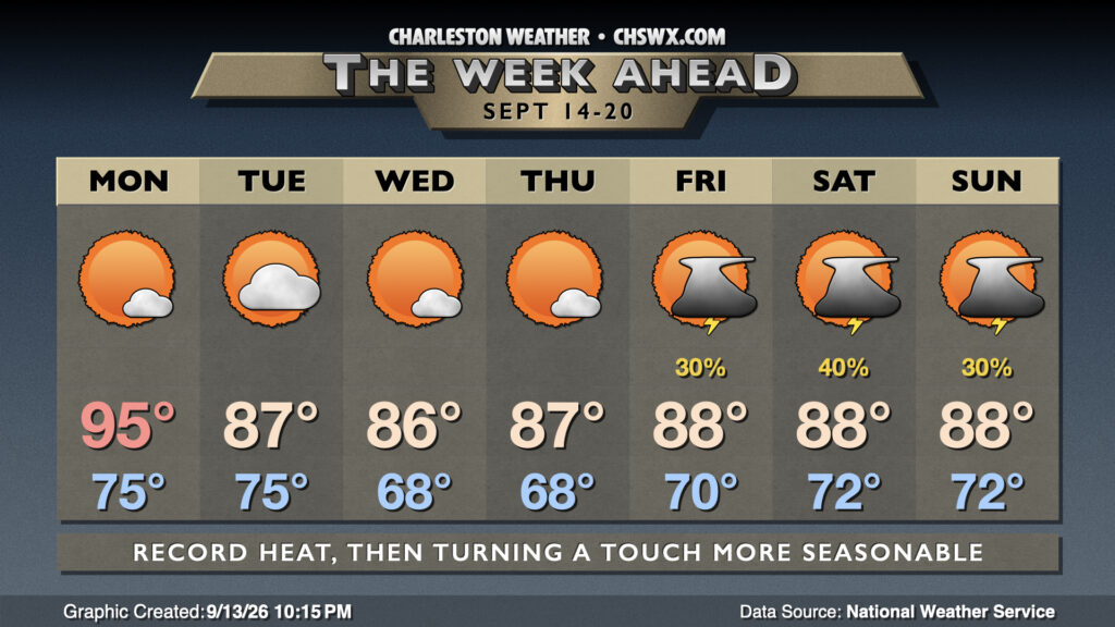
We tied a record high Sunday, and should at least threaten if not break the daily record again on Monday. From there, slightly cooler high pressure builds in from the northeast, bringing a little whiff of more seasonable air for mid-September.
But first, we’ve got one more really warm day Monday. Temperatures start in the mid-70s, warming to the mid-90s in the afternoon, challenging the record of 94° last set in 1994. Dewpoints will mix down to the low 70s inland, but heat indices could still push 100-105°, warmest near the coast. High pressure at the surface and aloft should keep us largely rain-free, though a popup on the seabreeze isn’t totally out of the question.
A front comes through Tuesday, flipping winds northeasterly (and turning a bit gusty as well) along with a bit more in the way of cloud cover (with a stray shower not totally out of bounds, either). These northeasterly winds will start to bring a bit more in the way of seasonable air into the area. After a muggy start, dewpoints will fall into the 60s as the day goes on, making highs in the upper 80s feel a little more comfortable. The only downside will be the risk for minor coastal flooding with Tuesday’s midday high tide, so keep the potential for some salt water flooding-related road closures in mind if your plans include downtown.
Temperatures will stay much closer to mid-September norms through mid-week, with lows even dipping into the 60s away from the coast. Highs peak generally in the mid-to-upper 80s each day with plenty of sunshine as dry air hangs around. As we get closer to the weekend, winds will head a little more easterly, bringing in a bit more of a fetch of moisture and nudging dewpoints back into the 70s. This will help bring back the risk for isolated afternoon thunderstorms. Highs generally will continue in the upper 80s each day with lows around 70° each morning.
Follow my Charleston Weather updates on Mastodon, Bluesky, Instagram, Facebook, or directly in a feed reader. Do you like what you see here? Please consider supporting my independent, hype-averse weather journalism and become a supporter on Patreon for a broader look at all things #chswx!