Friday & the weekend: Sunnier and warming
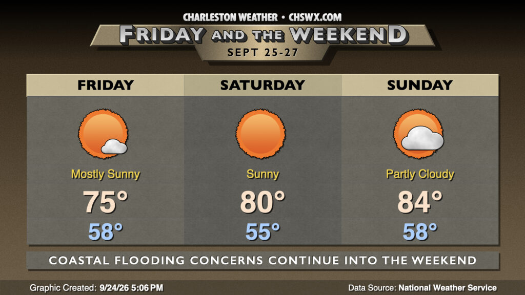
After a bit of a dreary and chilly day featuring a high struggling to 70° — the coolest day since we only topped out at 63° on May 2 — the sun returns to the forecast beginning Friday and lasting into next week.
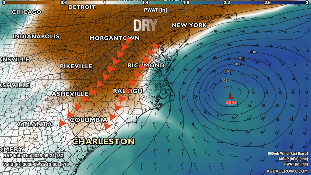
We should see cloud cover gradually break down overnight as drier air punches in from the north around the backside of the developing nor’easter off the North Carolina coast. This will yield quite a pretty day across the metro, though we’ll still see some elevated winds. Lows should drop into the 50s for the first time since spring, warming to the mid-70s in the afternoon under plenty of sunshine. A warming trend ensues starting Saturday, with highs around 80° warming to the mid-80s on Sunday. Meanwhile, lows in the 50s will continue each morning — certainly a breath of fresh air after the summer we just endured!
Coastal flooding threat continues into the weekend
Saturday’s full moon and strong northeasterly winds keep the risk for coastal flooding elevated heading into the weekend. Both of Friday’s tides, in particular, are expected to reach moderate flood stage, bringing about a risk for road closures with both the morning commute and the tail end of the evening commute. Coastal flood advisories will be a common sight over the next few days, so be ready to reroute if you encounter a flooded or closed road.
Follow my Charleston Weather updates on Mastodon, Bluesky, Instagram, Facebook, or directly in a feed reader. Do you like what you see here? Please consider supporting my independent, hype-averse weather journalism and become a supporter on Patreon for a broader look at all things #chswx!