The week ahead: Moisture returns, with rain chances following suit
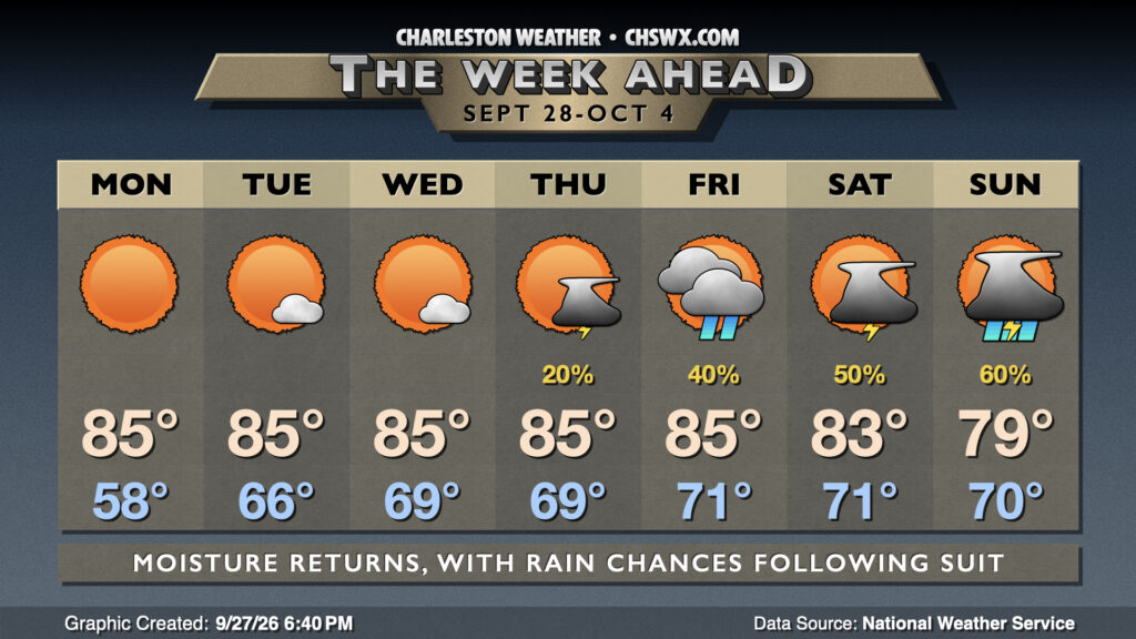
After a beautiful weekend, the pattern begins to shift back toward warmer and more humid conditions once more, bringing about the return of shower and thunderstorm chances later this week into the weekend.
First, though, we get one more crisp start on Monday, though it’ll run a bit warmer than we did on Sunday. Lows drop into the upper 50s to around 60° before warming back to the mid-80s in the afternoon under mostly sunny skies. Dewpoints will run a couple ticks warmer, but remain comfortable in the upper 50s. From here, though, high pressure begins to shift offshore, and return flow behind it begins to send dewpoints back into the 60s and even near 70° starting Tuesday, lasting into the weekend. High pressure aloft helps keep shower and storm chances down a couple more days, but we start to see seabreeze activity return to the picture on Thursday, with slightly better shower and thunderstorm chances as we head into Friday and the weekend, especially with the risk of a cold front getting nearby and stalling out. Highs will generally run in the mid-80s each day, with some higher temps possible further south.
Coastal flooding risk continues
The risk for coastal flooding will stick around heading into next week, primarily with the morning high tides, as lingering astronomical effects and a return to a bit more onshore flow will keep water levels elevated for the next few days. Keep an ear out for Coastal Flood Advisories and be ready to reroute around roads closed due to flooding.
Follow my Charleston Weather updates on Mastodon, Bluesky, Instagram, Facebook, or directly in a feed reader. Do you like what you see here? Please consider supporting my independent, hype-averse weather journalism and become a supporter on Patreon for a broader look at all things #chswx!