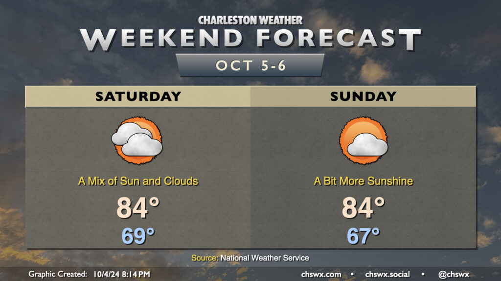
Quiet weather is expected this weekend as high pressure remains in control. Friday’s occasional showers will be a thing of the past on Saturday as cloud cover gradually thins throughout the day. We start Saturday in the upper 60s, warming to the mid-80s in the afternoon.
More sunshine is in the offing for Sunday as a trough of low pressure aloft moves out and a little bit of ridging moves in. We start the day a touch cooler, generally in the mid-to-upper 60s, warming once again to the mid-80s in the afternoon under partly cloudy skies.
The next front, which arrives with little fanfare on Monday, should finally bring a shot of more fall-like air into the area for next week, with lows possibly dipping into the 50s by next Thursday. Overall, the outlook is for generally quiet and dry weather for at least the next several days.
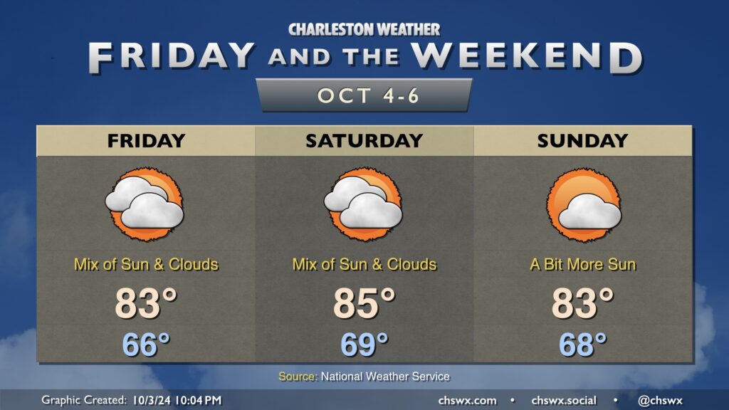
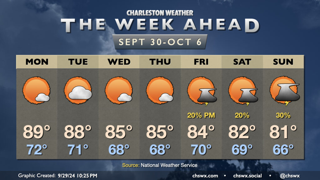
Not terribly much to write home about in the weather department this weekend as our weather looks generally quiet with above-normal temperatures expected. A bit more cloud cover works into the area Friday, with a stray shower possible at the coast in the morning. Otherwise, we stay rain-free for the foreseeable future as dry air aloft keeps a lid on shower activity. Temperatures on Friday start in the mid-60s, warming to the low-to-mid-80s in the afternoon.
Saturday runs a little warmer ahead of a weak front that’ll pass by with relatively little fanfare. A mix of sun and clouds is expected throughout the day, but once again, shower activity should be suppressed this far north. We start the day near 70°, warming to the mid-80s in the afternoon, likely a couple clicks higher than we will on Friday.
Post-frontal skies on Sunday will trend a little sunnier, with morning lows in the upper 60s warming to the low 80s in the afternoon. All in all, the next few days look pretty alright weather-wise.
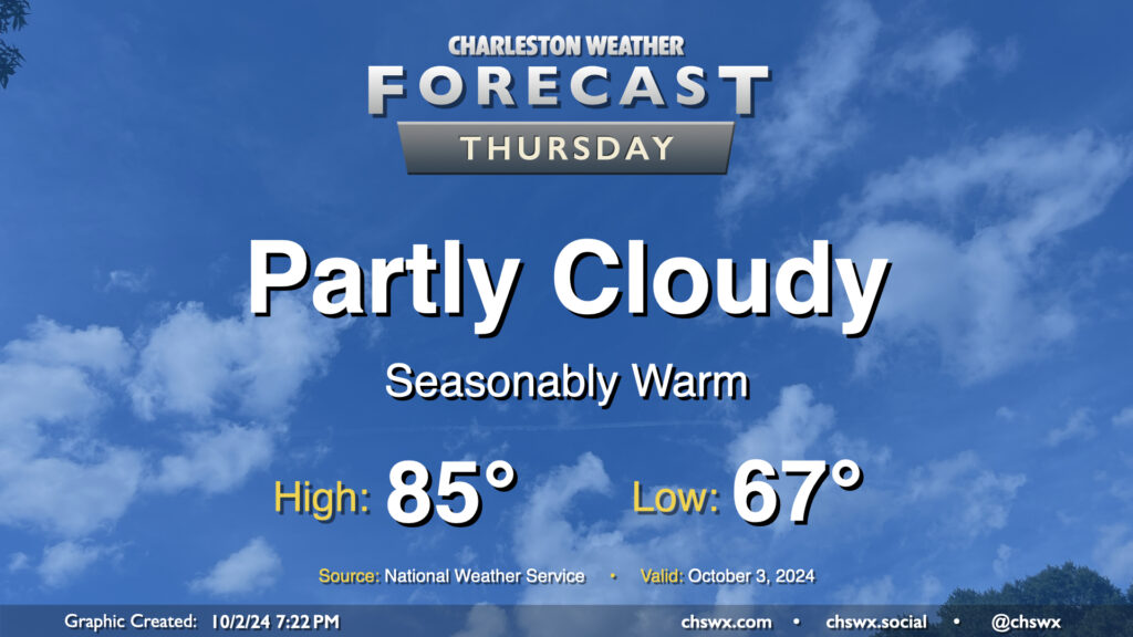
Quiet and seasonably warm weather continues for Thursday. We’ll start the day in the mid-to-upper 60s, warming to the mid-80s in the afternoon under partly cloudy skies. Dewpoints will run in the upper 60s, so it’ll still feel a touch humid, but it won’t be too bad overall. The only weather-related issue we could run into tomorrow would be a little bit of salt water on the roads around the 9:01am high tide. Water levels should peak around 7′, which is right where we generally start to see coastal flooding occur. Widespread impacts aren’t expected, but the usual trouble spots may once again be troublesome, particularly around Hagood and Fishburne.
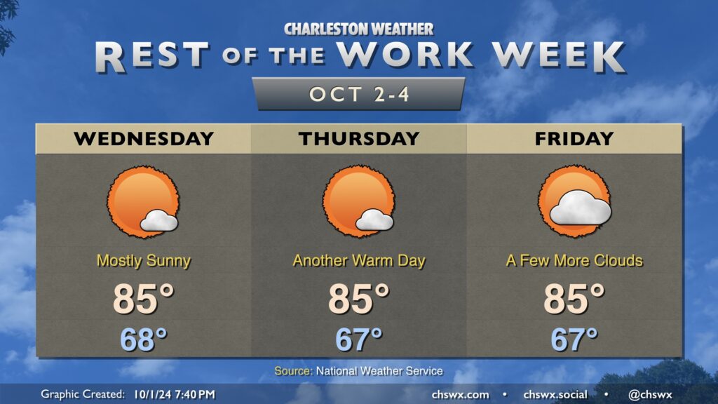
High pressure will be in control of our weather for the rest of the week both at the surface and aloft, bringing in quiet and seasonably warm conditions with a fair bit of sunshine, especially on Wednesday and Thursday. Temperatures each day start in the upper 60s, warming to the mid-80s each afternoon.
Rain chances will run essentially nil until late next weekend as a series of fronts move on by. These fronts should keep an area of low pressure in the Gulf of Mexico well to our south. While it may sling some moisture our way, any outsized impacts are not expected, and we actually have another round of slightly cooler and quieter weather expected by the middle of next week.
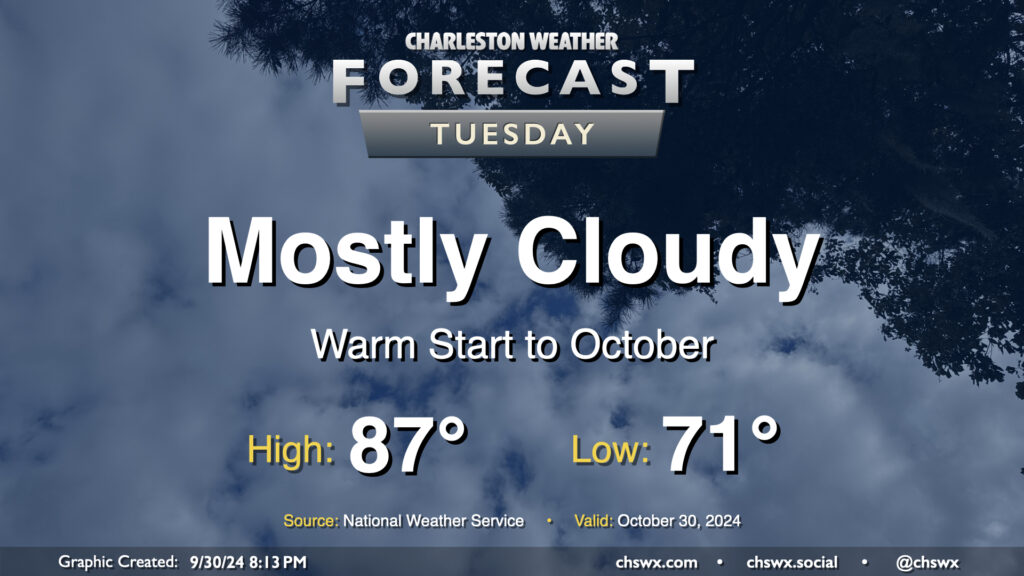
We’ll get October off to a warm but somewhat cloudy start before a cold front starts to regulate temperatures a bit more beginning Wednesday. We start the day rather mild for this time of year once again, with low 70s generally across the metro (and warmer toward the coast). Cloud cover does persist, but despite that, we’ll still warm into the upper 80s. Rain is not expected.
There’s not too terribly much to write home about in this week’s forecast so far, which is a fine departure from this point last week when we were looking at the genesis of what would become Hurricane Helene. We close September on a warm note, but a cooling trend begins to kick in by mid-week, with a few showers and thunderstorms — and much cooler conditions — possible by the weekend.