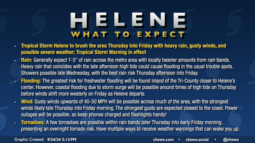
Hurricane Helene’s outer fringes will begin to affect the area on Thursday, with impacts peaking Thursday afternoon through Friday morning. Gusty winds, heavy rain, and a risk for tornadoes are the main concerns. A Tropical Storm Warning is in effect for the Lowcountry, including the entirety of the Charleston Tri-County area.
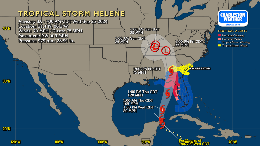
A Tropical Storm Watch is now in effect for the Lowcountry, including the Charleston Tri-County area, as Helene continues to organize and strengthen while it moves northward into the Gulf.
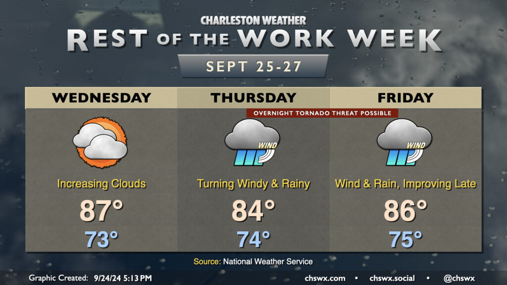
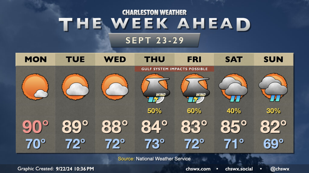
The rest of the work week will make you not want to hear the name “Helene” for a little while after it’s all over. We have one more day before wind and rain associated with the tropical storm arrive in the Lowcountry on Wednesday; it’ll be a warm and muggy day, but your last best opportunity to bring some loose things inside just to be safe. Temperatures start in the low-to-mid-70s, warming to the mid-to-upper 80s in the afternoon despite the increasing cloud cover. A few showers can’t be ruled out very late in the day, but the better chances for rain begin on Thursday.
On the current track, Helene will make landfall Thursday night in the Big Bend area of Florida as a major hurricane. It’ll be moving at a pretty decent forward speed, which should spread increasing showers and maybe thunderstorms into the area throughout the day Thursday. Helene’s impacts look to peak Thursday night into Friday morning, with gusty winds, heavy rain bands, and possibly a few tornadoes. Yes, we’ll need y’all to have your weather alerting devices in the on and alarming position Thursday night in case a tornado warning is issued. Some coastal flooding is also possible especially around high tide as onshore winds push some storm surge into the area, though the surge threat does not appear serious at this point.
Heavy rain and the tornado threat continue into Friday morning. Helene will be making quick work to the north and northwest, though, and we should see rain and wind gradually die down as the day goes on. Winds will start to take more of a westerly tack as Helene’s circulation moves away, and that should help blunt additional coastal flooding concerns on Friday. And by the weekend, we’re Helene-free.
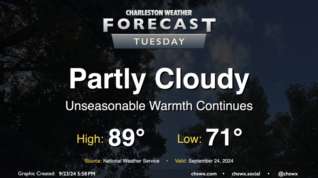
Quiet and unseasonably warm weather continues on Tuesday. Expect to start the day in the low 70s, warming to the upper 80s to around 90° in the afternoon. Dewpoints in the low 70s will yield heat indices in the mid-90s — not necessarily oppressive but certainly unpleasant considering where we are on the calendar. The ridge aloft will keep a lid on any shower activity, so no concerns there as we start to look ahead toward impacts from what is currently Potential Tropical Cyclone Nine later this week.
Well, it might be fall, but our local weather will continue to betray the calendar for a few more days as Atlantic high pressure to our east and ridging aloft keeps things warmer than normal as we head into the last week of September (already?). Then, things turn a little more interesting as we watch for the potential for a tropical cyclone to move northward through the Gulf of Mexico. Depending on how far east the storm develops and tracks, it’s possible we may see some impacts here at home, but it’s very tough to say exactly what that will look like just yet.