The week ahead: Turning warmer, but first, a little tropical mischief
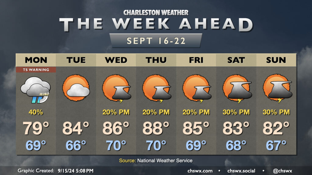
The area of disturbed weather along the lingering stationary front we’ve been watching for a few days off the coast has been tagged as Potential Tropical Cyclone Eight this evening, prompting a Tropical Storm Warning from Edisto Beach to Ocracoke Inlet, NC, including the Charleston metro area. It brings with it some breezy rain and an increased coastal flood risk for Monday, but is not expected to be a high-end event for the Lowcountry. Its stay will be brief, with warming and generally quiet weather in the offing for the rest of the week.
Read more »