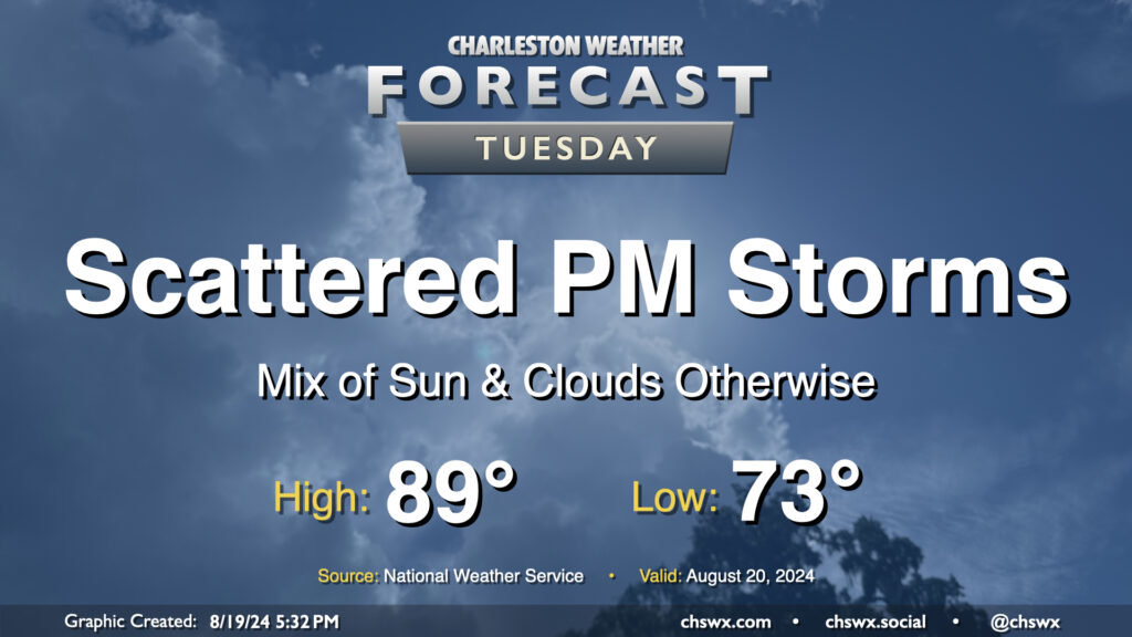
Tuesday looks a lot like Monday did (in the weather department, anyway) as a front continues to meander nearby, keeping the risk for a few showers and thunderstorms in the forecast in the afternoon primarily east of 17-A. Temperatures will follow a similar curve as well — we start in the low 70s (warmer toward the coast) and warm into the upper 80s to around 90° in the afternoon.
As far as storms go, a few folks could see some locally heavy rain thanks to slow storm motions, but otherwise, no severe weather is expected.
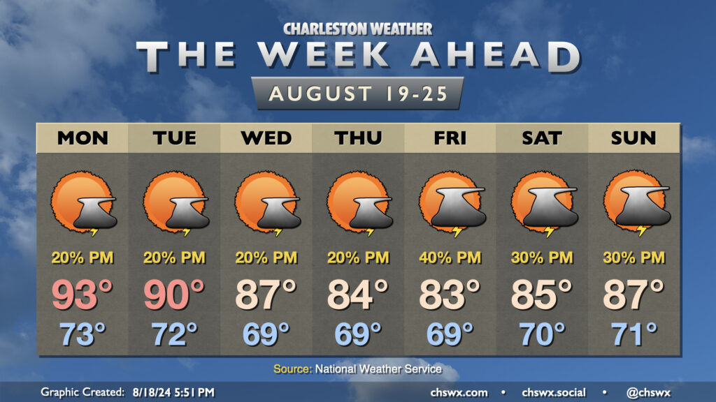
Another break from the heat is in the offing this week as cooler high pressure works its way into the area. We’ll really start to feel it beginning mid-week, and it should last well into the weekend.
One front gets by early Monday, stalling out nearby. This should cut down on coverage of afternoon storms, at least, but a couple storms can’t be ruled out as highs head to the low-to-mid-90s. The cooling trend begins on Tuesday as highs top out around 90°, and will continue for the rest of the week as highs fall into the mid-80s with minimal afternoon thunderstorm chances. Lows will bottom out in the upper 60s fairly routinely as well, with even some mid-60s possible in less urbanized locations.
Temperatures start to warm again as we get into the weekend, but highs should continue to run generally in the mid-to-upper 80s with scattered thunderstorm chances each day.