Friday & the weekend: Winter storm gives us mostly rain; back half of the weekend looking OK
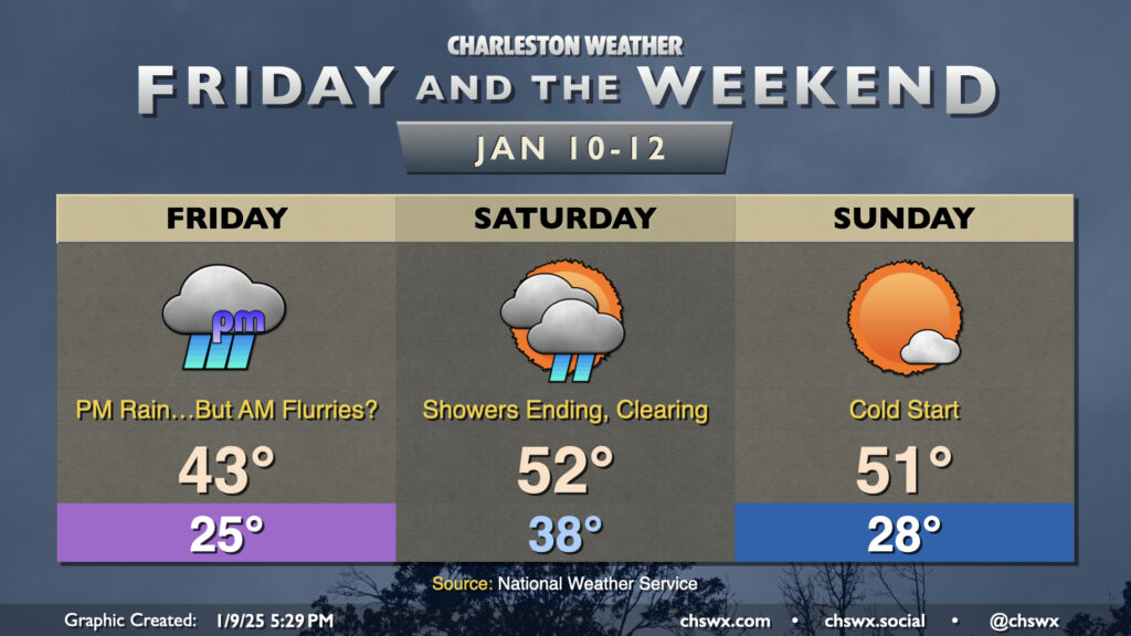
Low pressure organizing in the Gulf of Mexico, just off the southern Texas coast, will move east and northeast heading into Friday, bringing snow and ice to the I-85 corridor and an otherwise raw, gross day of cold rain here to the Lowcountry. We start the day in the mid-20s, and recent guidance signals that there is a slight chance of a few snowflakes through about 10am as a band of precipitation moves north across the area, with the best chance of catching a few conversational flurries further inland around I-95, but they won’t last as temperatures at the surface and aloft warm up. No traffic impacts are expected (unless someone gets distracted by a snowflake, anyway). There should be a little bit of a dry slot in the early afternoon before more steady rain moves in from the west along with the low; this will keep us in the rain for much of the mid-to-late afternoon into the overnight. Highs on Friday will crack the low 40s but won’t warm much more, so again, be ready to bundle up and stay that way if you’re headed out. (Honestly, a great night to stay in with soup and a good movie.)
Read more »